
The Fira to Oia Hike: A Complete Guide to Santorini's Best Walk

The hike from Fira to Oia is 10.5 kilometres along the caldera rim, past whitewashed villages, blue-domed churches, and volcanic rock, with the Aegean Sea visible below the entire way. Free, open year-round, and one of the best experiences on the island. Here's everything you need to know before you go.
There are faster ways to get from Fira to Oia. The bus takes 30 minutes and costs €2.20. A taxi costs around €25 and takes 15.
We walked.
The hike along the caldera rim is ten and a half kilometres of whitewashed villages, loose volcanic rock, blue-domed churches and the Aegean dropping away to the left the entire way.
It takes between two and a half and five hours, depending on your pace, costs nothing, and in many cases is the main experience visitors leave the island talking about.
What makes this trail different from any other coastal walk is what you're actually walking along.
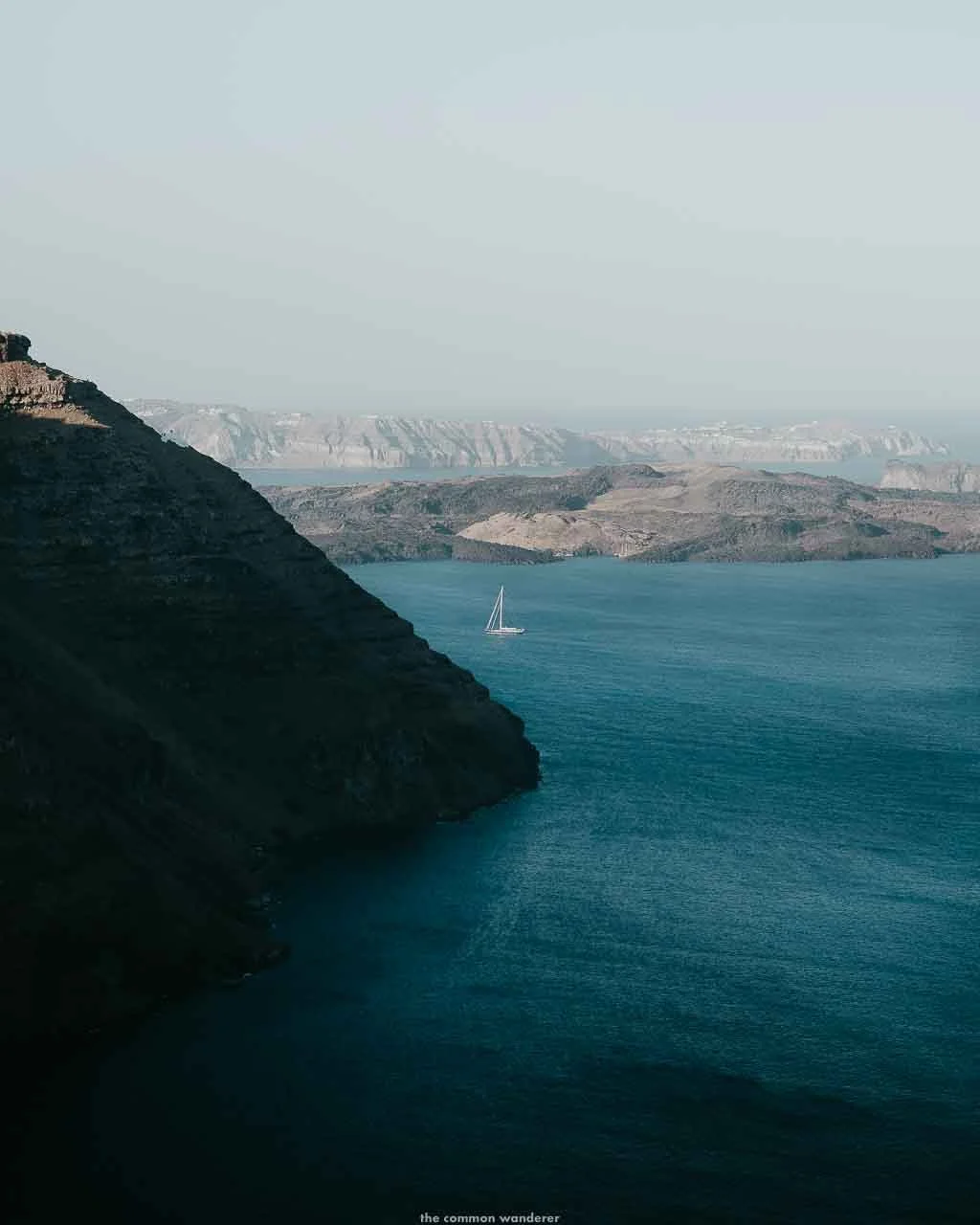
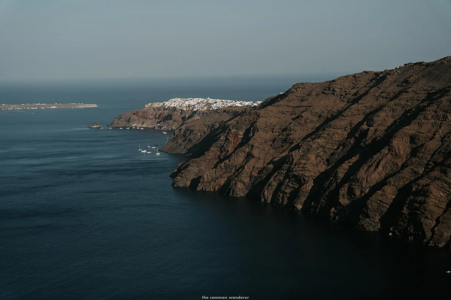
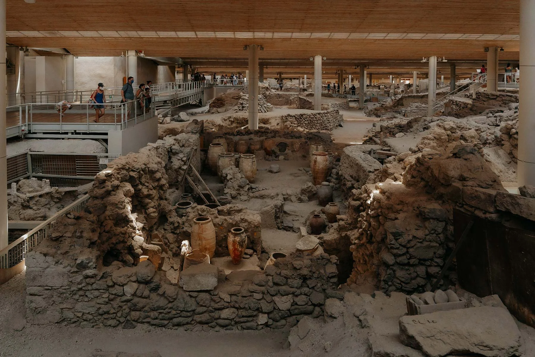
The steep crescent of cliffs beneath you is the inside wall of a collapsed volcano, formed when a catastrophic eruption around 1600 BC tore the centre of the island apart, and the land fell into the sea.
The layers of black, red and yellow volcanic rock visible in the cliff faces below the villages are the same ash and lava that buried Akrotiri and reshaped the entire Aegean. Walking the caldera rim gives you a sense of that geology in a way that no viewpoint from a terrace or hotel pool quite manages.
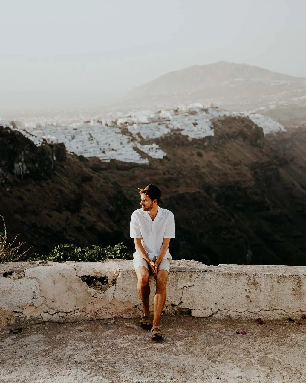
We stayed in Imerovigli, right on the trail, and walked sections of it at different times during our visit. The early morning version is the one we'd recommend, before the heat builds and before the day-trippers arrive in the villages. That version of the hike, with the light still soft and the trail mostly to yourself, is worth setting an early alarm for.
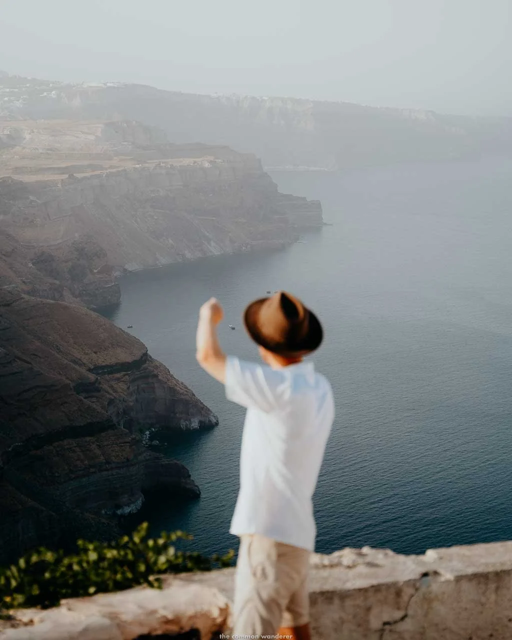
It's not an easy walk - the middle section between Imerovigli and Oia is rugged at times, with loose volcanic rock and no shade to speak of. The sun is unrelenting in summer, but the difficulty is part of what makes arriving in Oia feel like something worth celebrating (with a beer & gyros), and the views from the trail are unlike anything available from a tour bus window or a restaurant terrace.
This guide covers the full route in four sections, the best stops along the way, when to go, what to pack and how to get back to Fira when you're done.
LOVE OUR PHOTOS? Edit like us with our European Summers Preset Packs, and mobile video filters, inspired by the warm hues and vibes of summers spent in Europe
FIRA TO OIA HIKE OVERVIEW
DISTANCE | 10.5km (6.5 miles) one way
TIME | 2.5 to 5 hours depending on pace and stops
DIFFICULTY | Moderate - manageable for most fitness levels, more challenging in summer heat
BEST TIME TO GO | Early morning in summer - aim to leave Fira by 7am
WHAT TO BRING | 2 litres of water minimum, proper walking shoes, sun hat, sunscreen, snacks, cash, offline map
RETURN TO FIRA | Bus from Oia: €2.20, around 30 minutes. Taxi: around €25
TRAIL START | Metropolitan Church of Ypapanti Thira, central Fira
SKAROS ROCK DETOUR | Adds around 1 hour each way from Imerovigli, worth it if you have the time and energy
GUIDED OPTION | Fira to Oia guided caldera hike, includes hotel pickup and drop-off
PLAN YOUR FIRA TO OIA HIKE
IS THE FIRA TO OIA HIKE WORTH IT?
We walked sections of this trail multiple times during our stay in Imerovigli, and it was, without question, one of the best things we did on the island.
The views from the caldera rim are completely different from anything available from a hotel terrace or a tour bus window, and there's something satisfying about arriving in Oia on foot after covering the full length of it.
But it comes with a caveat, because in peak summer, the heat can be relentless, especially beween Imerovigli and Oia.
Avoid this by starting early, and packing ample water.
WHEN IS THE BEST TIME TO DO THE HIKE?
TIME OF DAY
Leave Fira by 7 am in summer. By 10 am, the trail is fully exposed, the heat is building, and the villages are filling up with day-trippers.
Starting early means the first hour or more on the trail is largely to yourself, which is a completely different experience.
If an early start isn't possible, late afternoon, once the heat has started to subside, works too, though be careful with daylight in shoulder season.
TIME OF YEAR
Late April to early June and mid-September to October are the best conditions for this hike. Temperatures are comfortable, the trail is quieter, and the light is exceptional. July and August are doable but demanding.
The trail is open year-round and quiet in winter, though some cafes along the route may be closed outside of season.
WHICH DIRECTION SHOULD YOU HIKE?
Fira to Oia. That's our recommendation and the one most people make after doing it.
The morning sun is behind you rather than in your face while walking north. The approach into Oia is mostly flat or gently descending, which is considerably kinder on tired legs than the reverse. And Oia is a far better reward at the end of a long day of hiking than Fira, which is a busy transport hub rather than a destination in its own right.
If you're staying in Oia, take the bus to Fira and start from there.
HOW DIFFICULT IS THE HIKE?
The first half, from Fira through Firostefani to Imerovigli, is mostly paved or cobblestone. The climb from Fira up to Imerovigli is short but steep, yet comfortable for most people.
The second half, from Imerovigli to Oia, is where it changes. The paved path ends, and loose volcanic rock and dirt trails take over, with steep descents and climbs and no shade at all.
This is the section that catches people off guard, and where proper walking shoes are necessary.
Families with older children can manage this hike, although pack a carrier just in case.
HOW TO GET TO THE FIRA TO OIA HIKE TRAILHEAD
The trail starts near the Metropolitan Church of Ypapanti Thira in central Fira (map), which is a large cathedral on the main caldera path and easy to find. Keep the sea on your left and follow the path heading north.
One practical note: Google Maps tends to route you inland on the direct road rather than along the caldera. Download an offline map on AllTrails or MapsMe before you leave, while you have wifi. The trail is mostly intuitive, but there are a few sections through Imerovigli where it's easy to go the wrong way.
HOW TO GET BACK TO FIRA FROM OIA
BY BUS | KTEL bus from Oia to Fira, €2.20, around 30 minutes. Buses run roughly every 30 minutes throughout the day in peak season. In summer afternoons after sunset, they fill up fast, and the wait can be significant. If you're hiking to Oia for sunset, factor this in.
BY TAXI | Around €25 from Oia to Fira. Scarce in peak season, particularly after sunset in July and August. Don't rely on flagging one down. Book ahead if the bus feels too uncertain.
THE FIRA TO OIA HIKE: FOUR SECTIONS
SECTION 1 | FIRA TO IMEROVIGLI
DISTANCE | 2.6km
TIME | 30 to 45 minutes
DIFFICULTY | Easy to moderate
The trail starts near the Metropolitan Church of Ypapanti Thira in central Fira (map). From there, keep the caldera on your left and follow the path north. Don't expect trail markers here, as there aren't any. Just head toward the sea and keep walking.
The first landmark worth pausing at is the Three Bells of Fira, the blue-domed Catholic Church of the Dormition perched above the caldera with its famous triple bell tower. Built in the mid-17th century and heavily restored since, it's one of the most photographed spots on the trail.
From Fira the path climbs steadily toward Firostefani, passing hotels and cafes with the caldera panorama opening up gradually to the left. This is the last easy resupply point before things get more remote, so top up on water here if you need to.
The Pink Sophia Maria cafe (map) marks the beginning of Imerovigli. Coffee, pastries and juices if you need a break. Gallis, on the main road just off the walking path, opens earlier and does good takeaway coffee.
Imerovigli itself is a maze. There are multiple paths, very few trail markers and at least one marker pointing slightly amiss. We went the wrong way more than once in a short period of time. Keep heading toward the Avalon Resort and Spa at the edge of town, where the proper hiking trail begins.
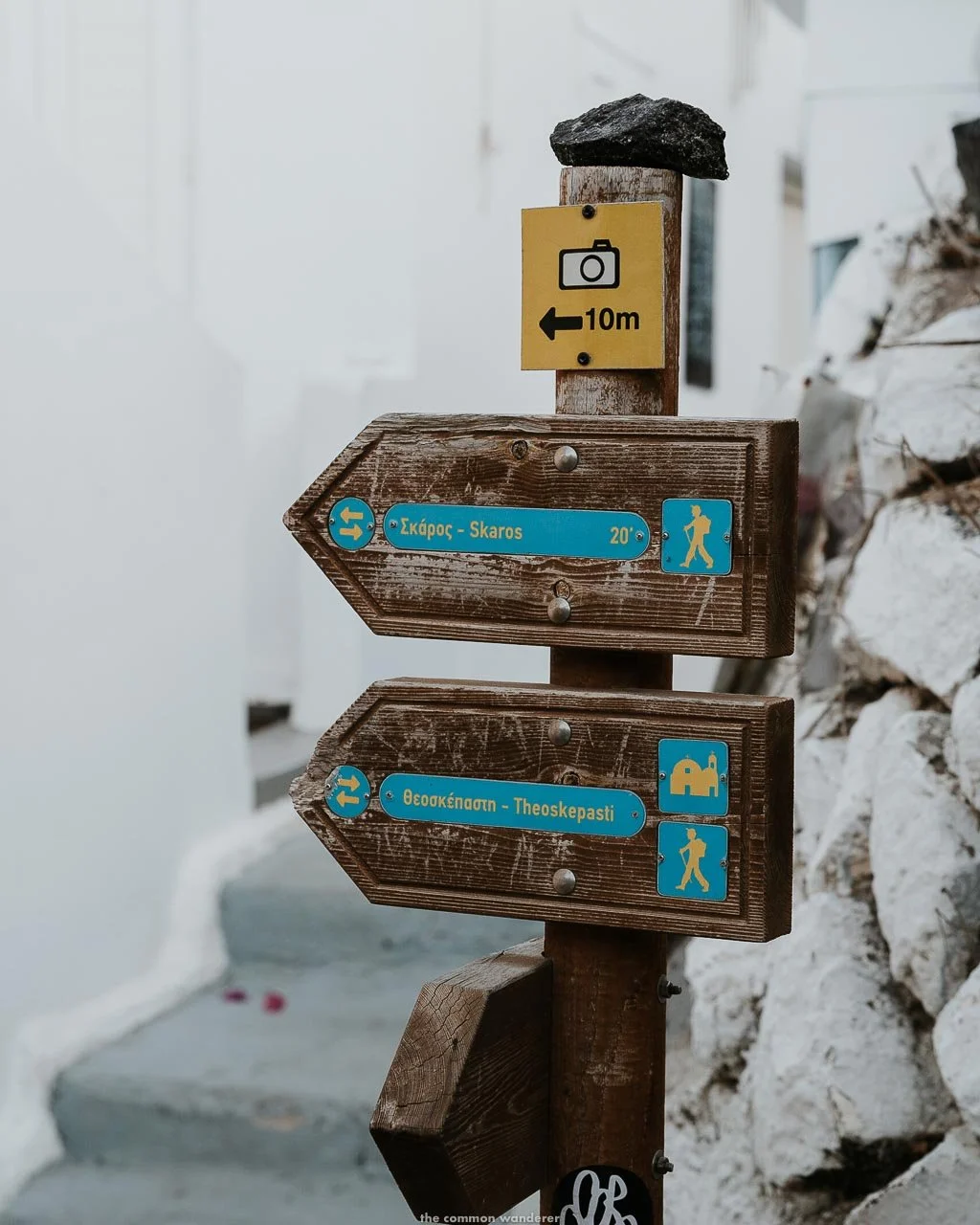
SECTION 2 | THE SKAROS ROCK DETOUR
DISTANCE | 3km return from Imerovigli
TIME | 45 minutes each way
DIFFICULTY | Moderate to hard
Optional, but worth it if you have the energy and time.
The path through Imerovigli eventually forks. A small sign points straight ahead toward Oia, or left and down to Skaros Rock. Take the left fork and follow the steps down.
You emerge from the village at the Katiforis Holy Orthodox Chapel, surrounded by sea with Skaros Rock directly ahead. The path forks again here. Left takes you along the side of the outcrop and down to the Chapel of Agios Ioannis Apokefalistheis, with extraordinary caldera and Aegean views along the way. The right-hand path through the ruins is technically closed for safety reasons.
The views from Skaros are, arguably, the best on the entire trail.
When you're done, retrace your steps back to the main path and continue toward Oia.
SECTION 3 | IMEROVIGLI TO THE CHURCH OF PROPHET ELIAS
DISTANCE | 2km
TIME | 30 to 45 minutes
DIFFICULTY | Easy to moderate
Past Imerovigli, the trail opens up. The narrow village lanes converge onto a single wider path at the Avalon Resort and Spa, and the character of the hike shifts.
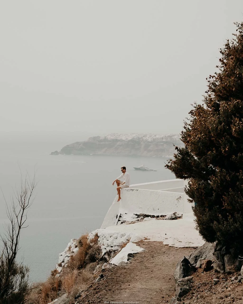
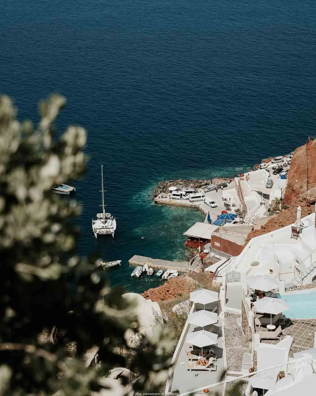
To the right, some of the finest boutique hotels on the island line the caldera path, Andronis Concept Wellness Resort, Divine Cave Experience, Rocabella and Nobu Hotel Santorini among them, their infinity pools hovering above the caldera and their guests reclining in the sun with what are, objectively, the best seats on the island.
To the left, the Aegean stretches out below. It's a strange and rather enjoyable stretch of trail.
The path goes gently downhill before levelling out, then climbs again past the Saint Mark Holy Orthodox Chapel. Looking back from here, Imerovigli's whitewashed buildings spill over the cliff edge.
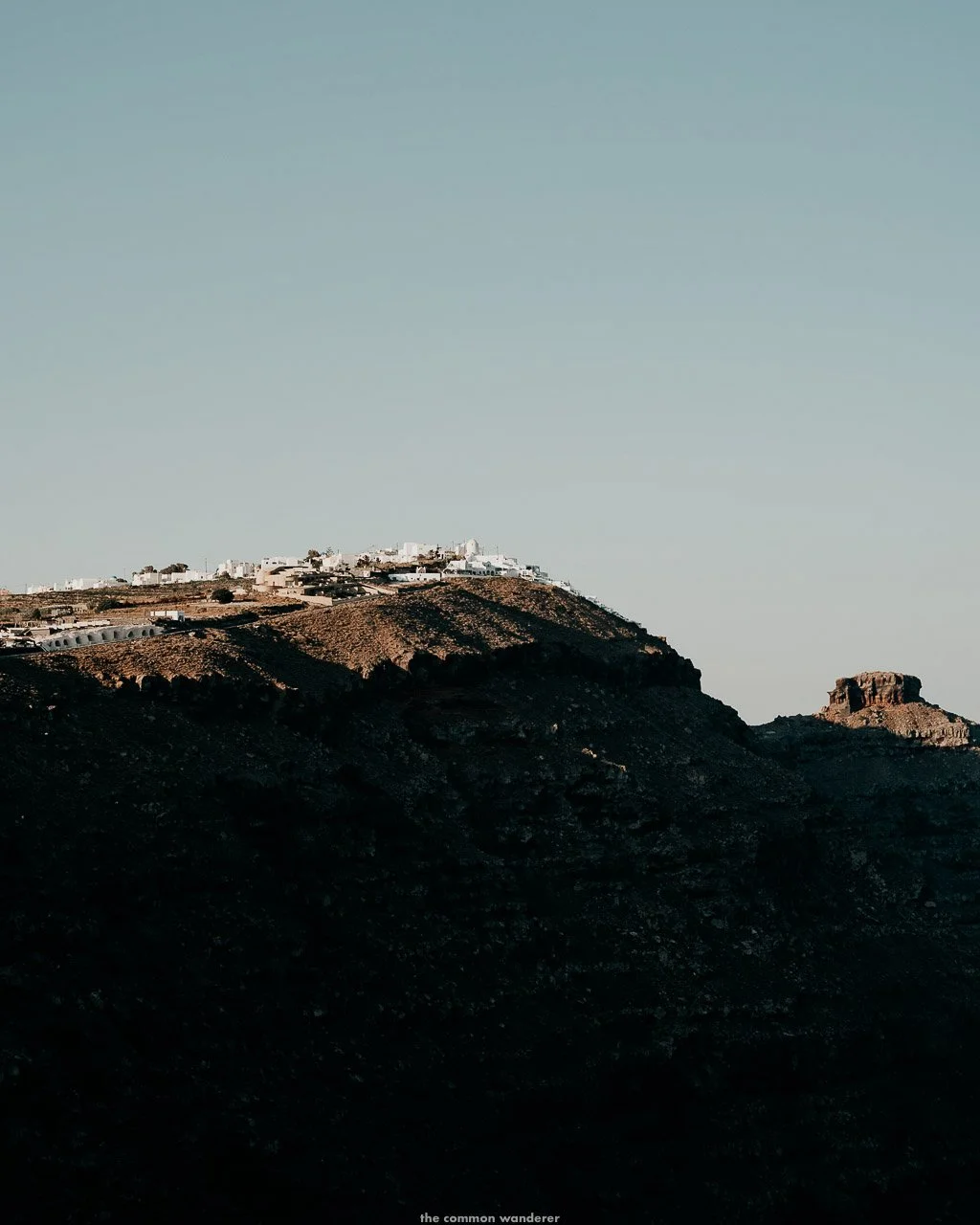
At the top of this climb sits the Church of Prophet Elias. A charming small Greek Orthodox church in the typical style: white walls, blue dome, three bells, and needle pine providing the only real shade on this section of the trail.
The second-highest point on the path is at 304 metres above sea level. A good place to pause, get your breath back and drink some water before the most demanding section begins.
SECTION 4 | CHURCH OF PROPHET ELIAS TO OIA
DISTANCE | 5.6km
TIME | 90 to 120 minutes
DIFFICULTY | Moderate to hard
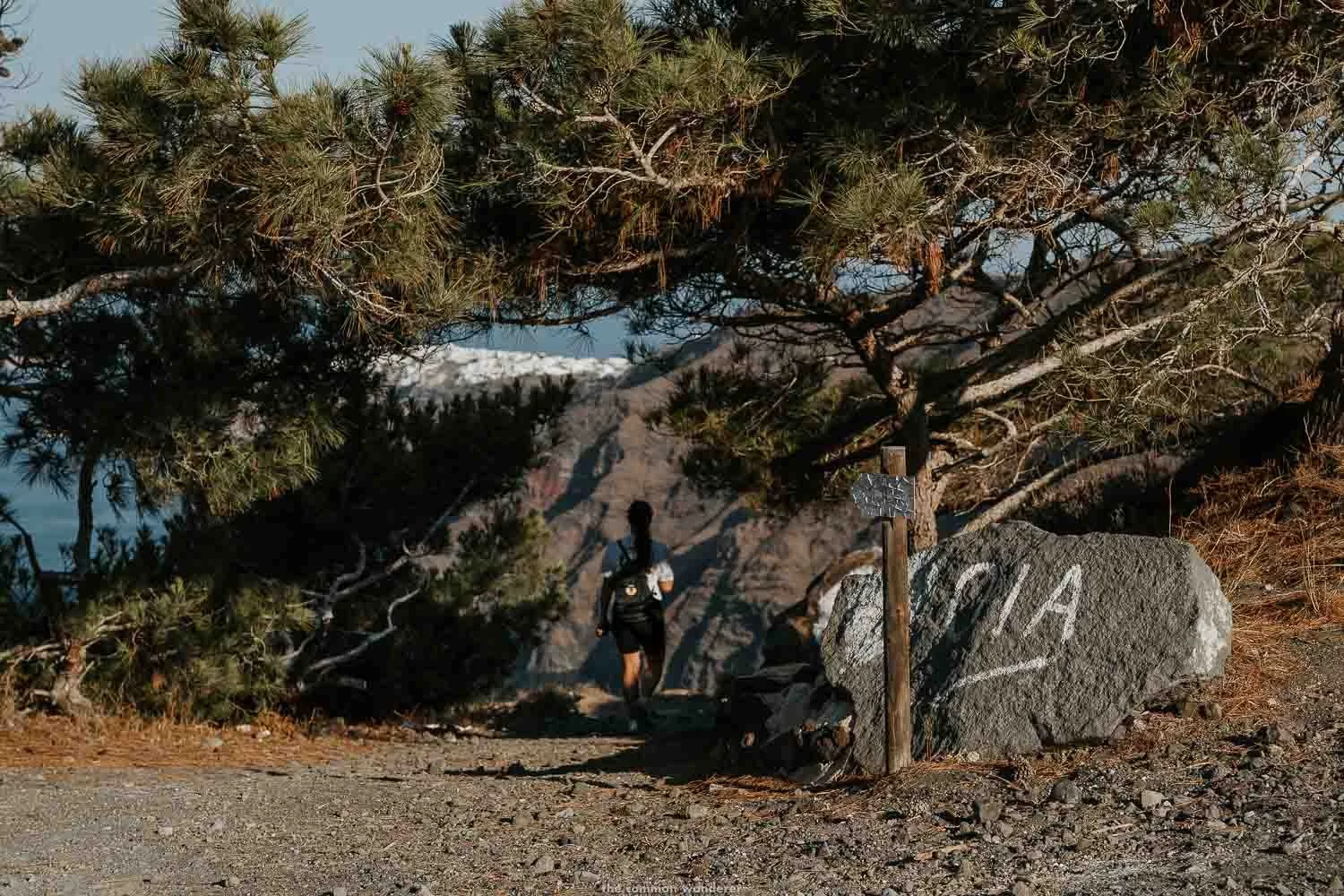
This is the section that catches people off guard.
The path descends left after the Elias chapel, marked by a rock with "OIA" painted in white, pointing toward the tree line. Shortly after, the paved path ends entirely. From here, it's dirt trail, loose volcanic rock and dust, and the terrain drops steeply in places, climbs again unexpectedly, and there's no shade at all.
This is the most remote and physically demanding stretch of the hike and the one that makes proper walking shoes non-negotiable.
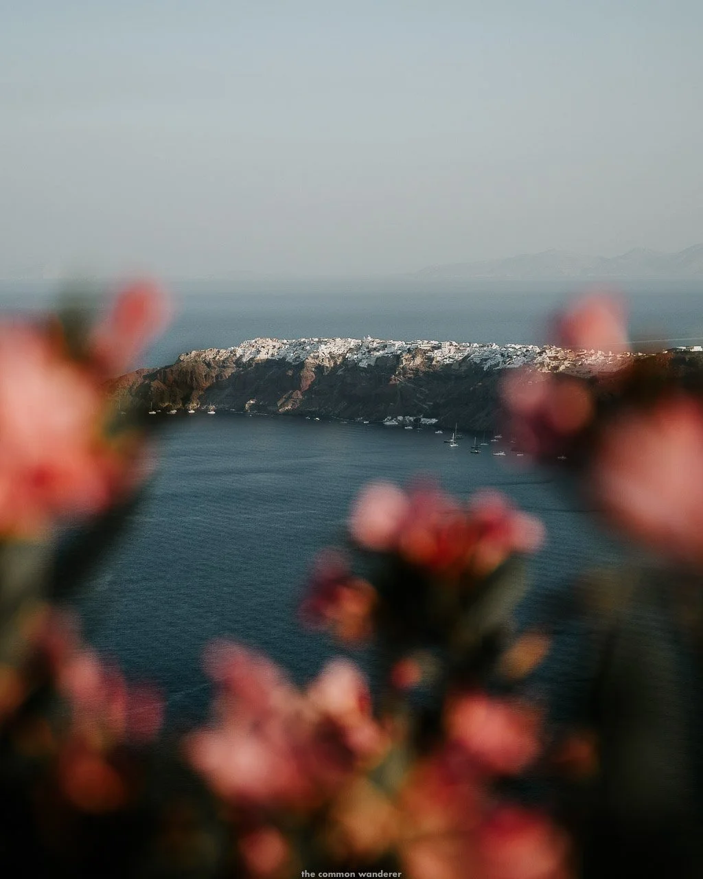
The views, though, are incredible. The caldera rim stretches out in both directions, layers of black, red and yellow volcanic rock in the cliff faces below, Imerovigli and Fira visible behind you and Oia shimmering in the distance ahead.
After a steep descent, the trail briefly joins the main road near Aenaon Villas. Follow it for around 400 metres until the Snack Shop (map), a cute cafe serving refreshments to the weary.
The trail picks up again past the cafe, marked by a signpost. From here it winds gradually upward toward the Chapel of the Assumption of the Virgin Mary, which is one of the most beautiful spots on the entire hike. A peach-painted wall, a yellow side building, the caldera sweeping in both directions and Oia visible ahead about 30 minutes away. The chapel shade is usually occupied by a cluster of other hikers doing exactly what you'll want to do: sit down for a few minutes and take it in.
From the chapel, the trail descends all the way to Oia through volcanic red rock and clusters of wide-faced prickly pear cacti. The terrain alternates between uneven cobblestones, worn volcanic pebbles and dust.
The cliffside hotels appear as you get close, the path widens and becomes well-maintained, and Oia's white buildings flood the landscape around you. When you reach the Luno Cafe, follow the walking path left rather than the main road right unless you're heading straight for the bus station. The walking path brings you into the village properly.
You've arrived. The Aperol Spritz is well-earned.
VIEWPOINTS AND PLACES OF INTEREST ON THE FIRA TO OIA HIKE
THE THREE BELLS OF FIRA
The Catholic Church of the Dormition, with its famous triple bell tower and blue dome, sits above the caldera about 15 minutes into the trail from Fira.
Built in the mid-17th century and restored significantly since, it's one of the most photographed spots on the island. Get your photos early before the rest of the trail's population catches up with you.
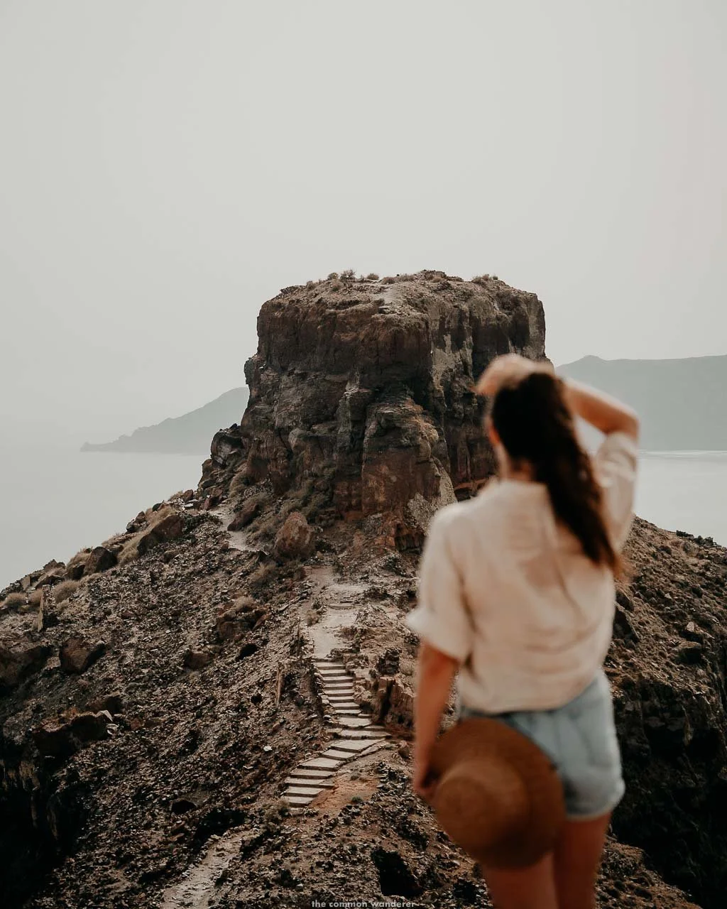
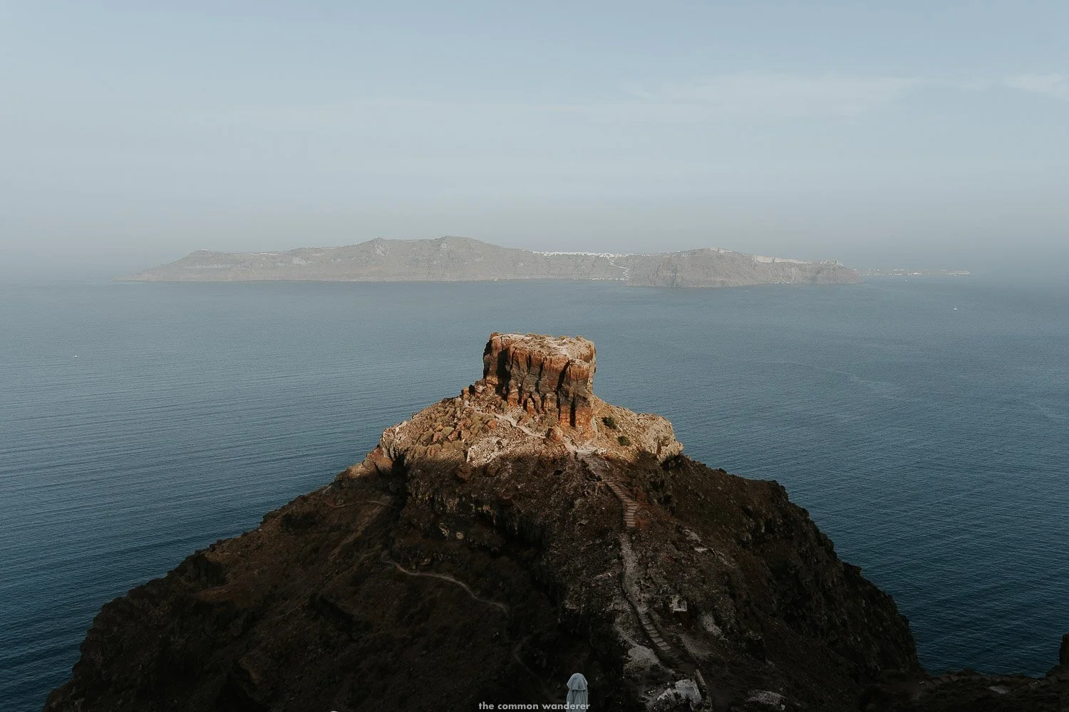
SKAROS ROCK
The most dramatic viewpoint on the entire trail and, in our opinion, the best on the island.
A jagged promontory jutting out from the cliff below Imerovigli, once home to a medieval castle that reportedly never fell to pirates over 600 years. An earthquake in the 18th century destroyed it, but the views from the rock are incredible: 360 degrees of caldera, Aegean and the island.
Allow 45 minutes each way from the main trail - we have a dedicated guide to Skaros Rock if you want the full details before you go.
CHURCH OF PROPHET ELIAS
A small Greek Orthodox chapel between Fira and Oia with spectacular views over both towns. The second-highest point on the trail is at 304 metres.
White walls, blue dome, three bells and a needle pine provide the only meaningful shade on this section of the route. It’s a good place to pause before the most demanding section begins.
THE ASSUMPTION OF THE VIRGIN MARY HOLY CHAPEL
About 30 minutes from Oia, this is the most beautiful spot on the second half of the trail.
A peach-painted wall, a daffodil yellow side building and panoramic views of the caldera in both directions, with Oia visible ahead and Imerovigli behind.
The shade here is usually occupied by a cluster of weary hikers, all doing exactly what you'll want to do: sit down and take it in for a few minutes.
From behind the yellow side hut, a short path leads up to Oia's highest point with 360-degree views of the caldera, the Aegean and the volcanic islands below.
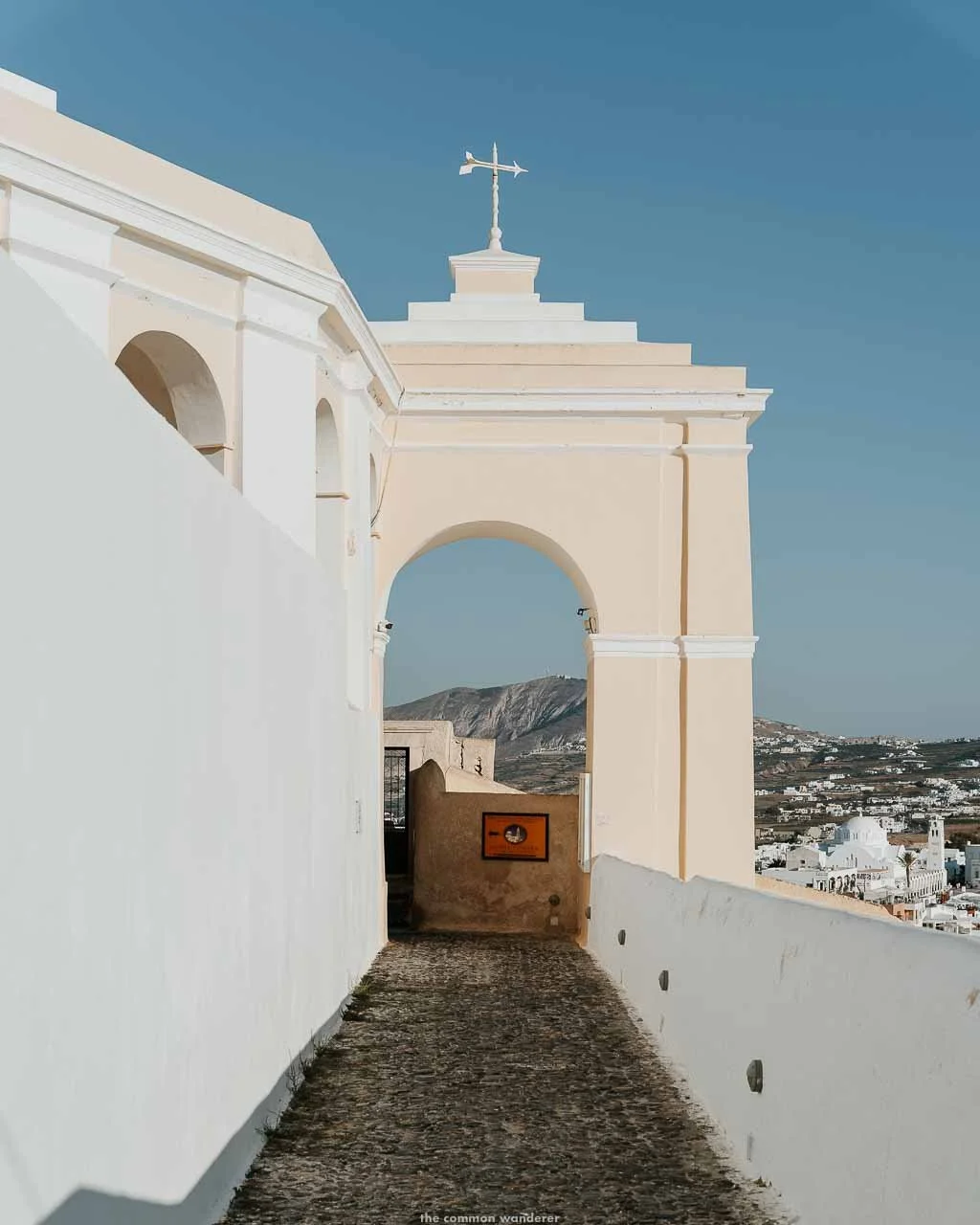
OIA CASTLE
At the far tip of Oia, the ruins of the Castle of Agios Nikolaos are all that remains of a 15th-century Venetian watchtower that once guarded against pirate raids.
It was destroyed in the 1956 earthquake, and what's left is a section of wall and a single tower with incredible views over the blue-domed village and the caldera beyond.
Better known as Santorini's most famous sunset viewpoint, which it is. Also, a good stopping point at the end of the hike before heading into Oia proper.
FIRA TO OIA HIKE: FREQUENTLY ASKED QUESTIONS
HOW LONG IS THE FIRA TO OIA HIKE?
The trail is 10.5km one way. Without stops, most people complete it in 2.5 to 3.5 hours. With stops for photos, viewpoints and a break in Imerovigli, allow 4 to 5 hours. The Skaros Rock detour adds around 1.5 to 2 hours on top of that.
IS THE FIRA TO OIA HIKE DIFFICULT?
Moderate overall. The first half from Fira to Imerovigli is mostly paved and comfortable. The second half from Imerovigli to Oia is considerably rougher, with loose volcanic rock, steep descents and no shade. Anyone in reasonable fitness can complete it. Proper walking shoes are essential for the second half.
IS THE FIRA TO OIA HIKE FREE?
Yes, completely free. The trail is public and open year-round with no entry fee.
CAN YOU DO THE FIRA TO OIA HIKE WITH KIDS?
Yes, with older children who are comfortable with uneven terrain and long distances. The second half of the trail requires careful footing on loose volcanic rock. Not recommended for very young children or prams.
WHAT IS THE BEST TIME OF DAY TO HIKE FROM FIRA TO OIA?
Early morning, leaving Fira by 7 am in summer. The trail is fully exposed from Imerovigli onward, and the heat is significant by 10 am in July and August. Late afternoon is the other option if an early start isn't possible, though watch daylight in the shoulder season.
WHICH DIRECTION IS BETTER: FIRA TO OIA OR OIA TO FIRA?
Fira to Oia. The morning sun is behind you, the approach into Oia is gently descending, and Oia is a considerably better reward at the end of the day than Fira. If you're staying in Oia, take the bus to Fira and start from there.
HOW DO YOU GET BACK TO FIRA FROM OIA?
The KTEL bus from Oia to Fira costs €2.20 and takes around 30 minutes, running roughly every 30 minutes through the day in peak season. A taxi costs around €25 and takes 15 minutes, though taxis are scarce in peak season. Book ahead for an evening return.
DO YOU NEED A GUIDE FOR THE FIRA TO OIA HIKE?
Not strictly necessary. The trail is mostly intuitive, though a few sections through Imerovigli can be confusing. Download an offline map on AllTrails or MapsMe before you go.
If you'd prefer a guided option with hotel pickup and drop-off included, this guided caldera hike is well-reviewed.
CAN YOU DO PART OF THE FIRA TO OIA HIKE?
Yes. The most popular partial option is Fira to Imerovigli, which covers the easier first half and includes the Skaros Rock detour. From Imerovigli, you can take the bus back to Fira. The Imerovigli to Oia section is the more dramatic and challenging half if you're starting from the middle.
IS THE FIRA TO OIA TRAIL WELL MARKED?
Mostly, but not entirely. There are occasional signs and distance markers, but they're infrequent. The confusing sections are mostly through the villages, particularly Imerovigli. Download an offline map before you start.
WHAT TO PACK FOR THE FIRA TO OIA HIKE
WATER | 2 litres minimum per person. There is one cafe between Imerovigli and Oia with unreliable opening hours. Don't depend on it. Stock up in Imerovigli
PROPER SHOES | Walking boots or sturdy runners with grip. The second half of the trail is loose volcanic rock in places. Not a hike for sandals or trainers with worn soles
SUN PROTECTION | Sunscreen, hat, sunglasses. There is no shade on the second half of the trail. Reapply sunscreen during the hike, not just before
SNACKS | Nothing is reliably available between Imerovigli and Oia. Bring enough to cover the full second half
CASH | The bus back from Oia takes cash. The Snack Shop, if open, is cash only
OFFLINE MAP | Download AllTrails or MapsMe before you leave, while you have wifi
PHONE CHARGE | A full battery before you start. There are no charging points on the trail
TRAVEL INSURANCE | STAY SAFE IN GREECE
Honest take: if something goes wrong, a medical emergency, a missed ferry, a scooter accident on a coastal road, travel insurance is the difference between a stressful story and a catastrophic one.
After 10+ years of full-time travel, here's what we use and recommend:
FOR TRAVELLERS | World Nomads offers travel insurance for independent travellers and intrepid families. Their policies offer coverage for more than 150 activities as well as emergency medical, lost luggage, trip cancellation and more.
Get a quote from World Nomads →
READ | Our ultimate guide to travel insurance
PLANNING A TRIP TO GREECE SOON?
Make the most of your time on Naxos with our essential Greece travel guides.
EXPLORE NAXOS
WHERE TO STAY ON NAXOS
Where to Stay on Naxos Island — hotels, villas and apartments across every budget and neighbourhood
MORE CYCLADES
DISCOVER THE BEAUTY OF GREECE WITH OUR GUIDES


Some of the links on this post are affiliate links.
If you choose to purchase using these links, we receive a small commission at no extra cost to you. Please know that by using these affiliate links, you're directly supporting The Common Wanderer to stay wandering, the running costs of the site, and our ability to provide you with free content to help you on your travels.
That, and you're officially a legend.