
15+ Breathtaking Dolomites Hikes to Add to Your Itinerary
Looking for the best hikes in the Dolomites? Look no further! Discover breathtaking trails that wind through alpine meadows, past towering peaks, and around crystal-clear lakes. Whether you're an experienced hiker or a beginner, there's a trail for you in our Dolomites hiking guide.
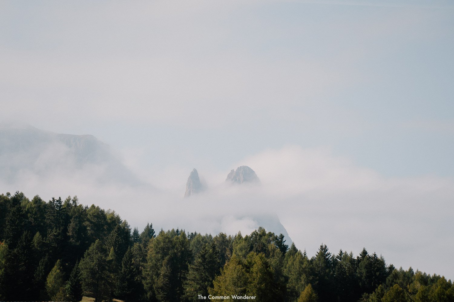
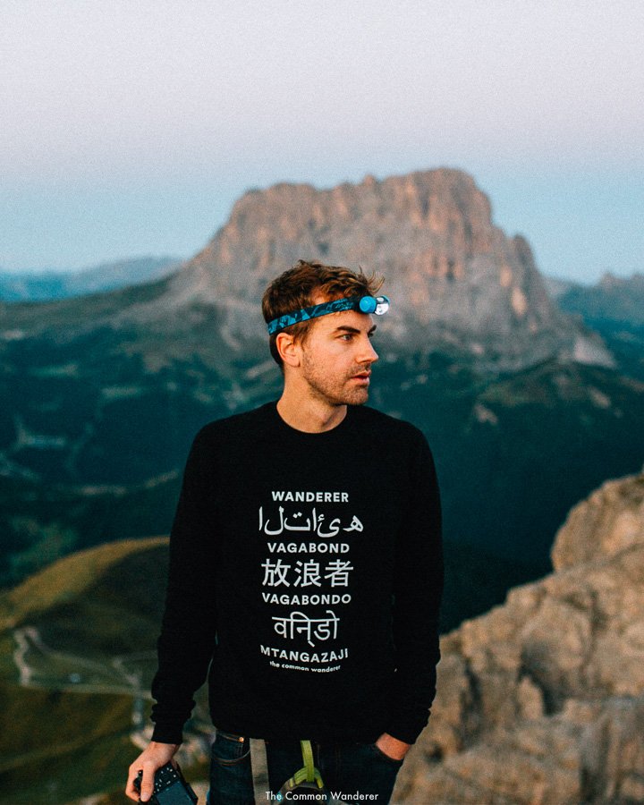
Hiking in the Dolomites is what we perceive hiking in heaven might be like; a mountainous wonderland with endless beer and hearty meals.
Throw in some friendly mountain folk and a dash of fresh air and you’ve got a pretty good picture of what this northern Italian utopia is really like.
Our first visit to the Dolomites was spent waking before dawn to chase epic sunrises from some of the most picturesque places we’ve ever seen. Our second visit was spent exploring all South Tyrol (a region in which the Dolomites exists) has to offer (and there’s a LOT!).
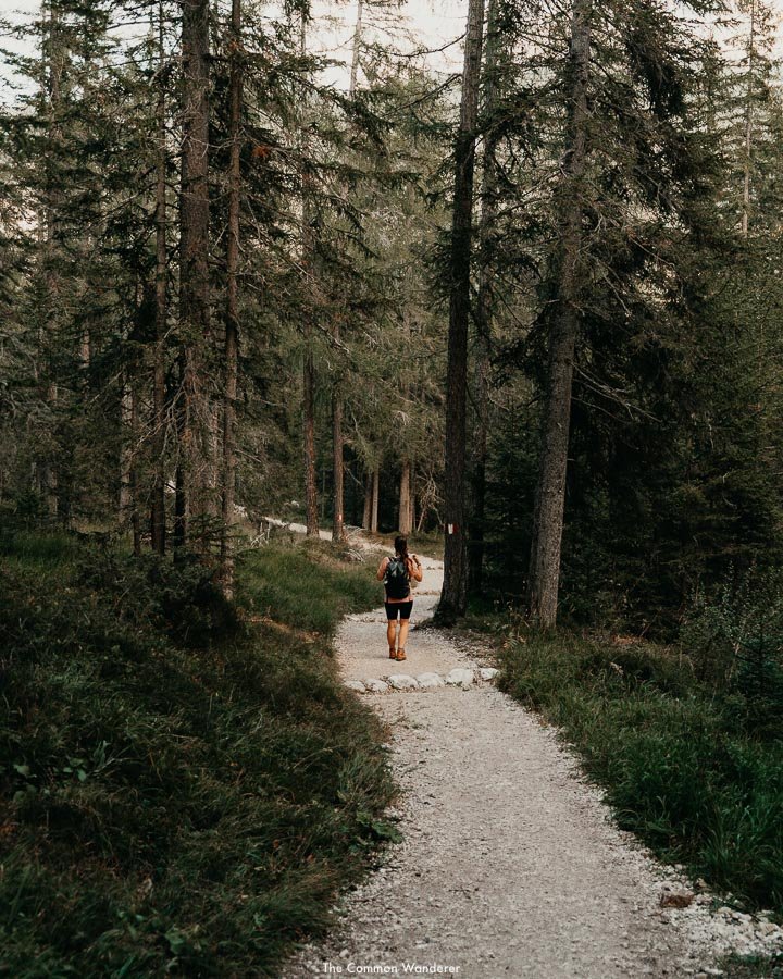
Through it all, we hiked. We hiked the limestone spires that forge through the clouds. We hiked, by via ferrata to watch in awe a burnt orange sunrise with jagged peaks. We hiked, slowly but assuredly, through green woods, alpine meadows and alongside rushing creeks to turquoise-coloured lakes.
We slept in quaint alpine huts, drank schnapps with raucous Italians, devoured cuisine good enough for Rome’s best restaurants, enjoyed a beer every.single.lunch, and generally lived our best lives.
You see, that’s the thing about hiking in the Dolomites - it’s meant to be enjoyed, from start to finish.
The 18 peaks that form the centrepiece of the Dolomites Unesco World Heritage site provide a wealth of incredible hiking opportunities for beginners through to experts.
This Dolomites hiking guide is written to help you guys enjoy the Dolomites’ best day hikes, short hikes, beer, food and views, on your visit to this part of the world.
So, hike on friends, and remember, a beer before lunch in the mountains doesn’t count.
DOLOMITES
HIKING
OVERVIEW
OUR FAVOURITE HIKE | Baita Seurasas, Burning Dolomites
MOST CHALLENGING HIKE | Croda del Becco
BEST BEGINNER HIKE | Adolf Munkel trail, Val di Funes
BEST HIKE WITH VIEWS | Lago di Sorapis
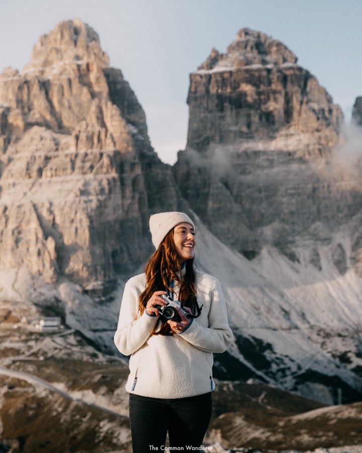
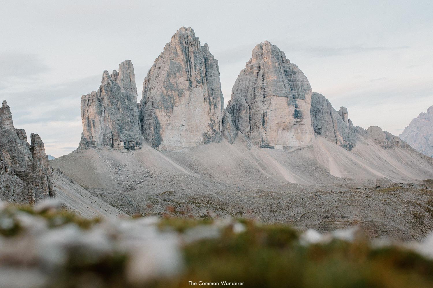
MOST POPULAR HIKE | Tre Cime di Lavaredo
15+ oF THE BEST DOLOMITES HIKING TRAILS
TRE CIME DI LAVAREDO/DREI ZINNEN | TRE CIME LOOP
Tre Cime di Lavaredo (The three peaks of Lavaredo) are as iconic to the Dolomites as the Eiffel Tower is to Paris.
It’s the landmark that fills your Instagram feeds, adorns postcards throughout the region, and is used on marketing materials enticing tourists from all over.
Let us assure you, they’re even more incredible in real life. The jagged monoliths of the famed Tre Cime di Lavaredo give you a real sense of awe as they tower above, clouds lingering at their peaks.
If you’re looking for a day hike in the Dolomites that gives you a real taste of what makes this region amazing, then the Tre Cime loop is for you.
The 10km loop hike starts at Rifugio Auronzo and follows a circular pathway around the imposing three peaks, which loom high above as you walk the circuit.
The wide gravel path flows gently east towards Cappella degli Alpini, a quaint alpine church, before extending on to the first of many picturesque mountain refuges, Rifugio Lavaredo.
Continue straight on towards Forcella Lavaredo for one of the best viewpoints on the entire Tre Cime di Lavaredo loop - from here you can see the three peaks looking imposingly above, while the rest of the Dolomites open up in front of you.
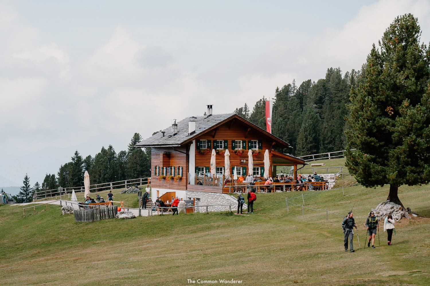
The path is littered with alpine huts perfect for lunch and beer, but we recommend stopping at Malga Langalm - it’s the most relaxed and comfortable rifugio on the hike, and the perfect place to enjoy some summer sun and a beer or two.
The final part of the Tre Cime di Lavaredo hike is fairly easy, following the path on a slight incline around the three peaks towards Forcella del Col de Mèdo viewpoint, before finally making it back to the carpark.
Overall, the pathway is very well managed and easy to follow, so we recommend this walk for any fitness level, however, it does get very busy during the peak season, so we recommend arriving early.
THE DETAILS
Where | Tre Cime di Lavaredo/Drei Zinnen
Distance | 10km Duration | 4+ hours Difficulty | Moderate
RELATED | We’ve written a detailed guide to hiking the Tre Cime di Lavaredo loop, so we recommend checking that out here
CADINI DI MISURINA HIKE | TRE CIME DI LAVAREDO
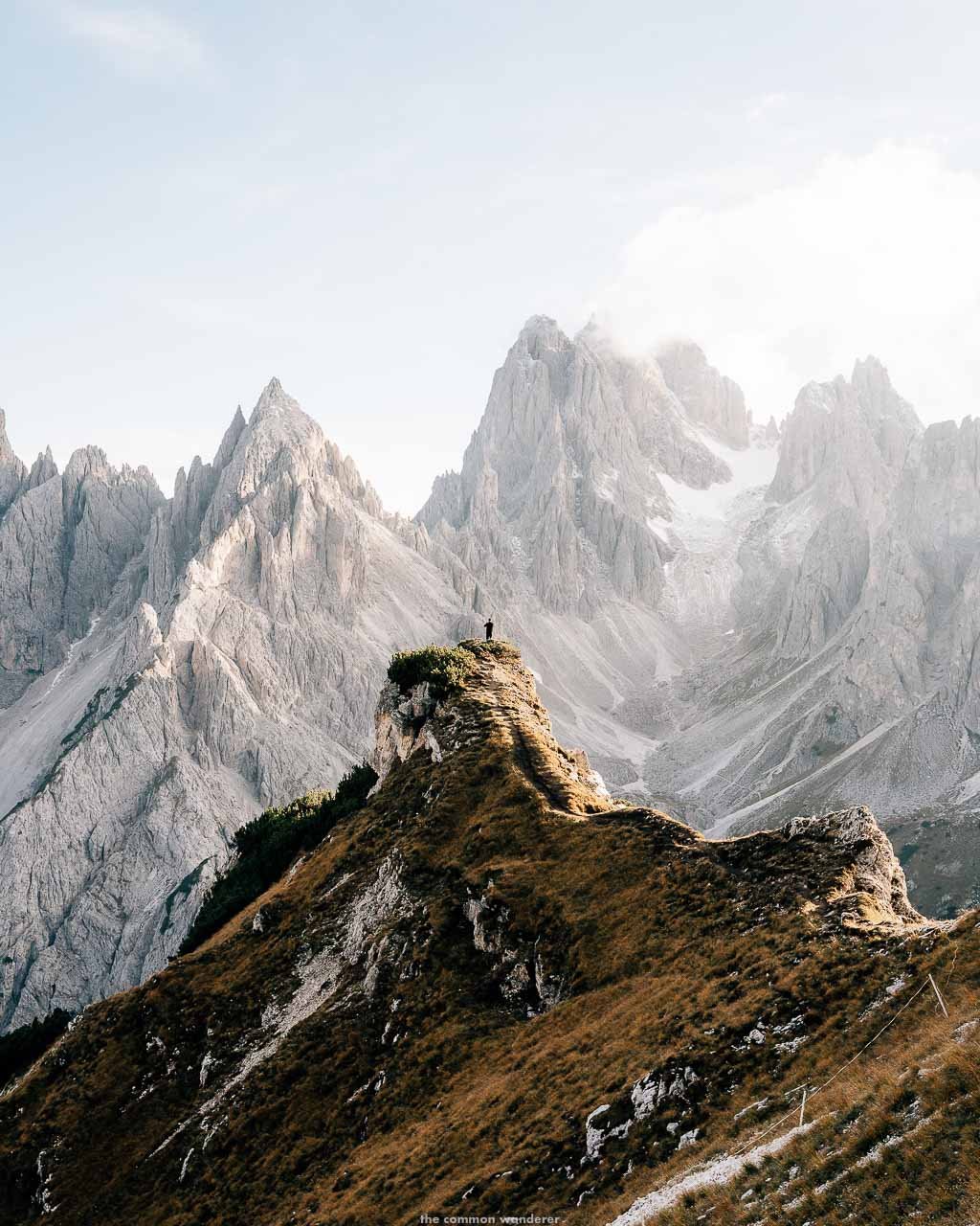
In a region filled with some of the most wondrous natural sites in Europe, it's sometimes hard to be wowed by the Dolomites.
Located opposite the equally imposing Tre Cime di Lavaredo in the Dolomites, Cadini di Misurina are a group of mountains that soar like sharp rock monoliths from the surrounding valley below. What separates them from the rest of the Dolomiti mountains is their striking formations, boundless layers and grandness - they stand strong, big and beautiful, changing their appearance through each hour of the day.
There are two ways to hike to Cadini di Misurina - the short hike from Rifugio Auronzo, which is short, but comes with a €30 toll charge, or from Lago d’Antorno, which is more strenuous, but free!
FROM RIFUGIO AURONZO
Start at the carpark and walk to the Rifugio. Follow the nondescript path on the right. You should see the unique peaks of Cadini di Misurina in the distance. Look for the sign for hiking trail #117. This is the 9.2km trail to Rifugio Col de Varda. Follow it to start the hike.
The hike starts rocky with a 500m downhill walk until the path levels out. Follow the path along the ridgeline with Auronzo di Cadore valley on your left and the peaks surrounding Cortina d'Ampezzo on your right.
After a while, the path leads up to Cadini di Misurina. At the junction, choose the right path for a more relaxed hiking experience. Follow the pathway right and you'll slowly make your way up and around the ridgeline. After around 15 minutes, you will arrive at a pathway that leads down to the famous Cadini di Misurina viewpoint.
Spend an hour or so taking photos, having a picnic, or simply enjoying the views. The hike back is mostly downhill, with Rifugio Auronzo always in the distance. It should take around 30 minutes to return to the carpark.
FROM LAGO D’ANTORNO
To avoid paying the €30 toll fee, you can take an alternative hike from Lago D'Atorno car park to Cadini Di Misurina. Be warned, some parts of the hike are quite steep and mostly uphill.
Starting at Lago d'Antorno, follow path 101/119 uphill through the pine forest towards Rifugio Auronzo. After about 45 minutes, you can veer right and take the path up to Cadini di Misurina viewpoint instead of towards Rifugio Auronzo. The 4.5km return hike has an elevation gain of over 500m, making it quite strenuous.
However, the views are worth it and you'll save €30.
READ MORE | Our complete guide to the Cadini di Misurina viewpoint
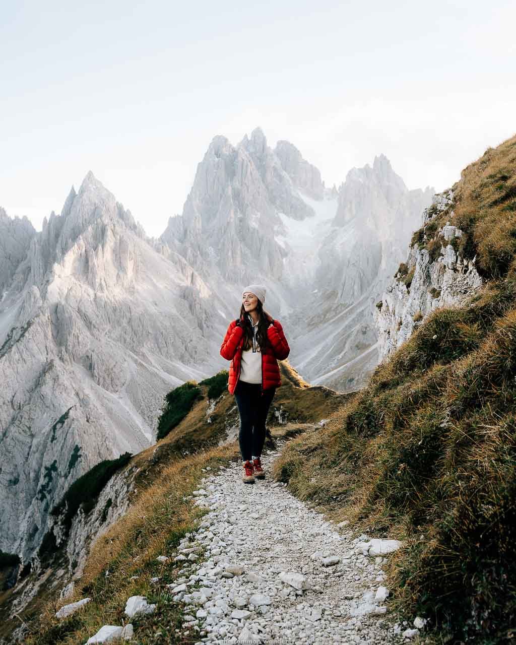
LAGO DI SORAPIS | CORTINA
The Dolomites are famous for their crystal clear lakes, such as Lago di Braies, Lago di Carezza and Lago di Dobbiaco, but the wholly unique turquoise hues of Lago di Sorapis are worth the somewhat challenging day hike (read our complete guide to the hike here).
The 2-hour trek is one of the best day hikes in the Dolomites, and commences from the carpark on Passo Tre Croci (in between Cortina d’Ampezzo and Misurina), ascending slowly through dense pine forests.
Before long, the trees clear and the epic vistas of Tre Cime and the surrounding Dolomites peaks come into view. The path continues along a small rock ledge with some exposed cliff sections, where a little balancing is needed.
Continuing for a short while longer and the first glimpses of the milky-blue Lago di Sorapis under the imposing Mt. Sorapis above - a clear sign of your final destination.
The lake itself isn’t huge, but its distinctive colour and position in the foothills of the jagged Dolomiti peaks make it one of the most picturesque in the region - it’s jaw-droppingly beautiful.
We recommend exploring the shores of the lake (no swimming though, folks - that’s banned here), before heading to Rifugio Vandelli for a snack/beer (but pack your own lunch as we’ve read the food isn’t great here).
THE DETAILS
Where | Lago di Sorapis, Cortina
Distance | 11km Duration | 4+ hours Difficulty | Moderate - hard
READ | Our complete guide to the Lago di Sorapis hike
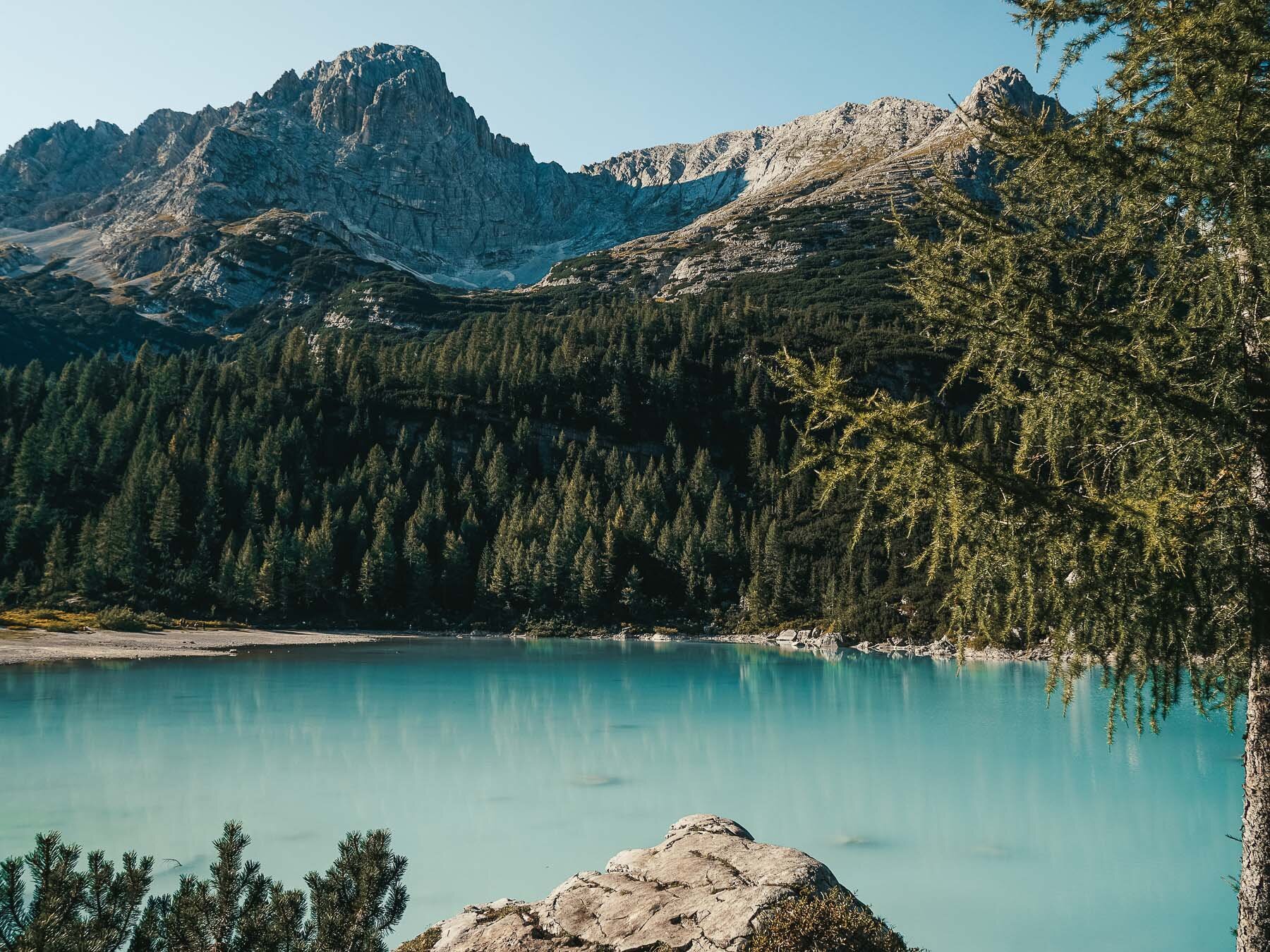
Image credit | Ben Lawrence
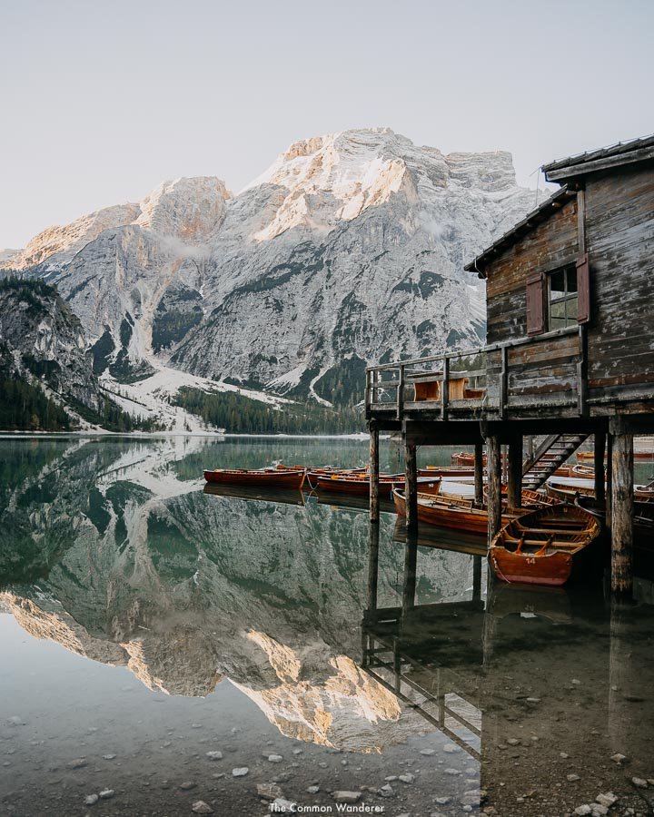
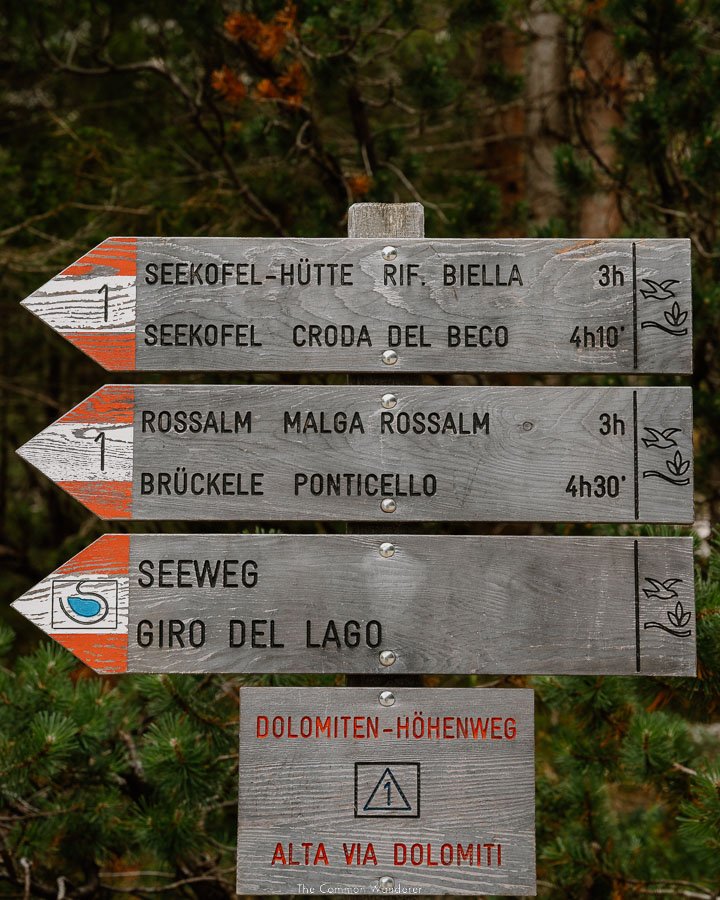
CRODA DEL BECCO | LAGO DI BRAIES
Most people come to the Dolomites to visit one of two things - Tre Cime di Lavaredo and the holy grail of Dolomites attractions, Lago di Braies.
The most iconic alpine lake in the Dolomites, Lago di Braies is famous the world over for its emerald waters, recognisable boat house, beautiful spruce pine forests and towering limestone peaks. And while most people visit for a few quick photos around the lake, there are a number of longer Dolomites day hikes that leave from here.
The best of these hikes is to the peak of Croda del Becco (Seekofel).
The Lago di Braies to Croda del Becco (Seekofel) hike isn’t for the faint of heart - it’s a seriously tough, steep hike for seasoned hikers, yet the views from the top are as rewarding as any in the Dolomites.
Starting at the southeastern end of the lake, ascend towards Buco del Giavo, taking the steep and rocky path slowly to Forcella Sora Forno. From here, it’s another rocky section towards the cross at the peak of Croda del Becco (Note: there are some exposed sections which are secured with rope/chain).
The views from the peak are breathtaking - a 360° view of the surrounding mountains of the Fanes-Sennes-Prags Nature Park, as well as a unique view over Lago di Braies below.
The hike is physically demanding with an elevation rise of over 1000m, so we definitely recommend rewarding yourself by dropping into the quaint Rifugio Biella for lunch and a beer (mains: €10, beer: €4.20), before the descent back to Lago di Braies.
THE DETAILS
Where | Fanes-Sennes-Prags Nature Park
Distance | 11.5km Duration | 6 hrs Difficulty | Hard
Tips | Consider another hike if you’re afraid of heights. Wear sturdy boots with a good grip
READ MORE | Our guide to Lago di Braies
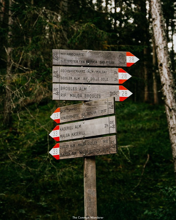
ADOLF MUNKEL TRAIL | VAL DI FUNES
Probably the most famous hike in the region, the Adolf Munkel trail is awe-inspiring at every turn. It takes in much of what makes this region famous - the serrated peaks of Odle-Geisler, deep pine forests, expansive meadows and some really, really good rifugio’s to enjoy a meal/beer at.
That being said, it’s not a hike for everyone - it’s a little on the harder side and best suits those who are experienced hikers with a good level of fitness.
There are many different trailheads depending on your starting point and your planned route for the walk, however, the official starting point is in the town of Zans, just east of Val di Funes.
From here, follow the Adolf Munkel trail signs (no.35) east towards Dusler Alm. This path cuts through the pine forests, before arriving at the Dusler meadow which provides lovely views of the Odle-Geisler peaks above, including the two tallest, Furchetta (3025 m), Sass Rigais (3025 m). You can stop here at the exceptionally pretty rifugio, or continue onwards and upwards towards Geisler Alm (trail 36).
This is the hardest part of the hike, with an elevation gain to get your heart racing. We chose to stop at the pretty Rifugio delle Odle for lunch, which, although expensive, was totally worth it. Alternatively, head further up the path towards the equally pretty Gschnagenhardt Alm. There are also a number of areas to sit and eat your packed lunch.
After a break admiring the towering peaks, head towards them, before following the trail left to start your descent back towards Zannes (trail 35). This part of the trail runs right along the rocky foot of the Geisler-Odle peaks before veering left (no.6 trail) to Zannes.
If you’d prefer to hike from Ranui/Val di Funes proper, you can take the forested no. 28 trail, ascending towards Broges Alm, before heading west on the No. 35 trail until Gschnagenhardt Alm hut and Rifugio delle Odle. Then, follow the 34A trail back down to Ranui.
It’s worth noting that parking in Zannes is €8 between 7 am and 1 pm.
For more details on the Adolf Munkel trail, click here
HIKE DETAILS
Trailhead | Parcheggio Malga Zannes
Distance | 13km Duration | 5 hrs Difficulty | Moderate
GEISLER ALM HIKE TO RIFUGIO DELLE ODLE | VAL DI FUNES
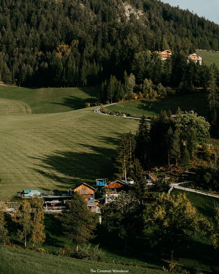
One of our favourite day hikes in the Dolomites, this moderate trek follows through forests, over gushing creeks, and past epic views of Val di Funes, before making its way to the famous Geisler Alm, a beautiful alpine meadow that sits just below the jagged peaks of Odle-Geisler (and on the other side, the famous Seceda ridge line).
The 12km round trip is quiet, shaded, and easy, and can be split by a visit to the ever-popular Rifugio Delle Odle.
One of the most popular rifugio in all of the Dolomites, Rifugio Delle Odle serves a range of South Tirolean meals, including dumplings, schlutzkrapfen, and kaiserschmarrn. And beer. Lots of beer. We recommend stopping here, grabbing a seat on the expansive terrace, and enjoying food and beer in the sun. Expect to pay around €25 per person for food and a drink.
Just behind the rifugio is ‘Cinema delle Odle’, with the incredible mountain range the main actor. If you’ve brought your own food, we recommend settling here to sit on the sun loungers, and swivel chairs, and watch the theatre of the mountains before you.
The trailhead starts just passed the famous St. Johann in Ranui church, near Walschenke restaurant. Following trail 28, the wide path slowly ascends through the tall pine forest alongside a gentle stream that descends from above. After about 20 mins of semi-strenuous walking, the path splits in two - take the left path (trail 34A) and follow the signs for Geisler Alm.
From here, the walk gets a little harder, with a 40-minute uphill slog through the dense pine forests. Take your time and enjoy the silence of the forest, stopping to view the vast Val di Funes valley below.
The path takes a sharp right and eventually, you’ll arrive at an intersection - follow the trail right, continuing uphill towards Geisler Alm. From here there are a few switchbacks, which can hurt already weary legs, but the reward is just a short while away - Rifugio Delle Odle.
After you’ve relaxed and enjoyed brunch, lunch, a snack, or even a beer, we recommend heading further into the meadow towards the Odle-Geisler peaks - the views here are stunning, and offer a more imposing view of the sheer rock face of the mountain peaks above. It’s also where you can join the famous Adolf Munkel trail (more on that below) if you’re after a longer, more challenging walk.
To return back to Santa Maddalena, follow the path back the way you came. However, if you’d prefer to change things up a little, as you approach the first fork in the path, keep right on trail 34 towards Zans, before following the signs back to Santa Maddalena.
You can view (and save) the trail here.
HIKE DETAILS
Trailhead | St. Johann in Ranui
Distance | 12km Duration | 3.5 hrs Difficulty | Easy
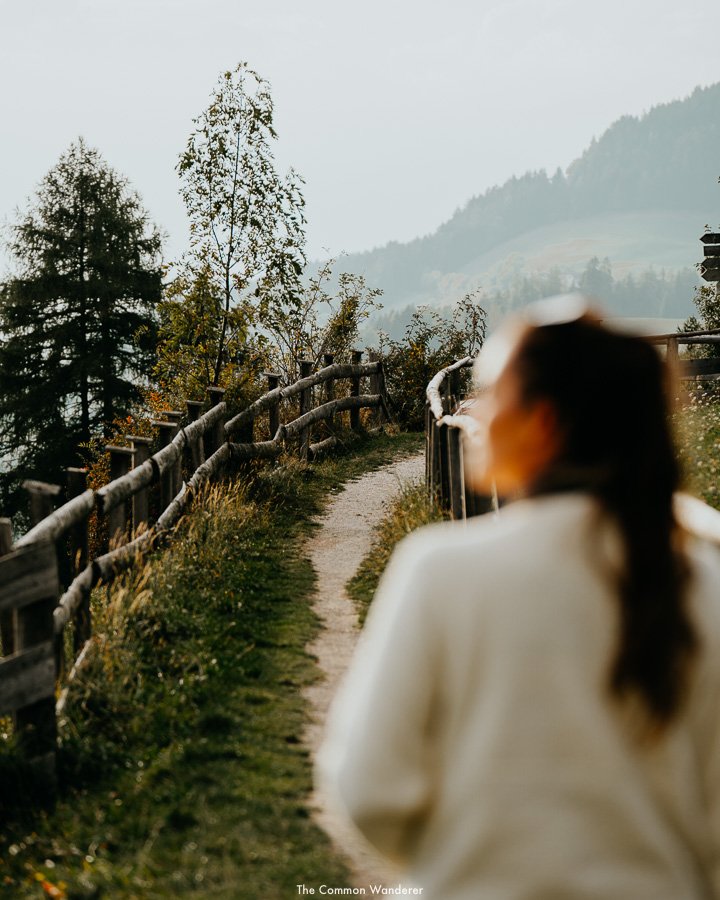
VAL DI FUNES PANORAMAWEG
One of the easiest and best hikes in Val di Funes is the Panoramaweg, a gentle path that provides the best views of the valley and surrounding peaks.
Starting in the centre of the valley and meandering toward San Pietro, the hike passes Santa Maddalena church, the famous Santa Maddalena viewpoint featuring the Puez-Geisler panorama, past rustic farmhouses, over rolling hills, through forests and of course, over the wildflower-filled meadows.
For anyone visiting Val di Funes, this is the hike we always recommend, so if you’re visiting the valley over a day, and wish to experience its most wonderful views, we suggest taking this hike.
The trailhead for the Val di Funes Panoramaweg starts in Santa Maddalena town proper, following the pathway toward Santa Maddalena church. Stop and take a look inside the church and its grounds, before following the paved Magdalenaweg road north-west towards the famous viewpoint.
Keep an eye out for the Panoramaweg sign to your right, which will take you up a small view to the Santa Maddalena viewpoint - you’ll know it when you see it. Take a moment or 10 to take it all in, and snap a few photos before setting off again on your hike.
From here, take the trail further up the hill until you see the Panoramaweg, which then follows west for around an hour, passing meadows and forests, with the serene views of the Puez-Geisler peaks looming large. This is probably the most enjoyable part of the hike, where there’s little else to enjoy but the sounds of the mountains.
Eventually, you’ll arrive at an intersection - you can either continue along the path or join the Sunnseitenweg shortcut back to Santa Maddalena. If you’re short of time or hanging out for lunch, this is a great alternative. Otherwise, continue on your way to San Pietro.
Returning from San Pietro, take the Sunnseitenweg trail back. This path is pretty much the same as the Panoramaweg trail, just slightly lower in the valley.
Follow the All Trails map here
HIKE DETAILS
Trailhead | Santa Maddalena
Distance | 7 - 9 km Duration | 3.5 hrs Difficulty | Easy
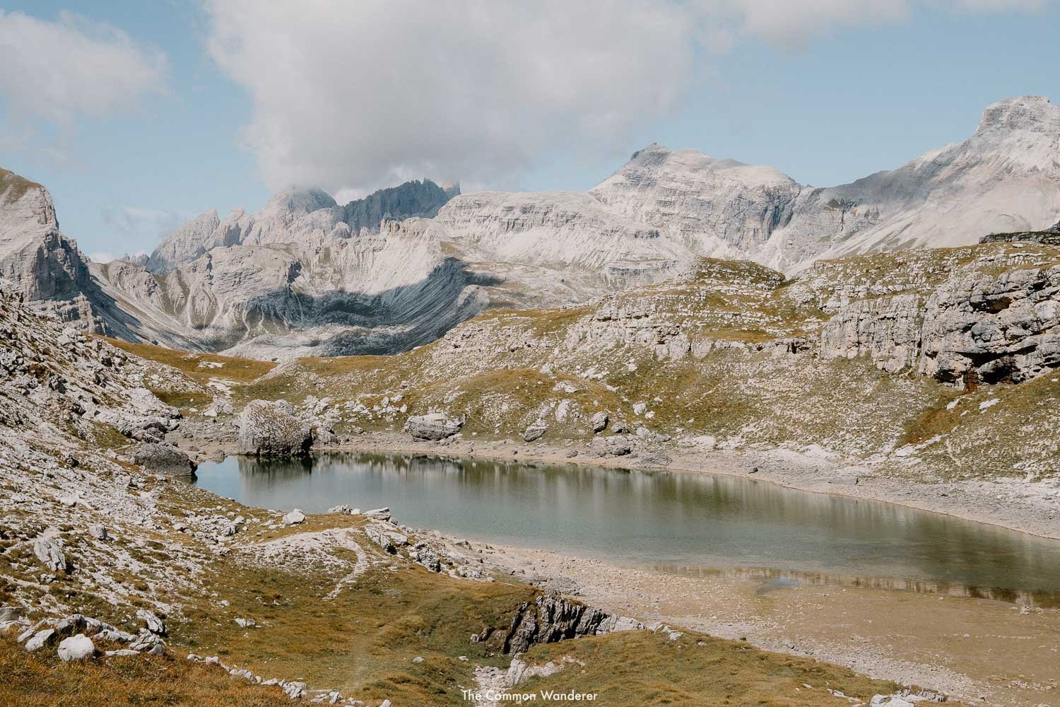
CRESPËINA LAKE - FORCELLA CIAMPËI PASSAGE HIKE | ALTA BADIA
This is the perfect day hike for those wanting to experience the best of Alta Badia.
Starting from Passo Gardena, the hike (trail #2) slowly makes its way through the mountain pastures to Jimmi Hütte (where we totally recommend stopping for breakfast/coffee if you haven’t eaten already). From Jimmi Hütte, again follow trail #2 through the steep, craggy slopes for around 30 minutes, stopping to appreciate the Sella Group and Sassolungo as you gain elevation.
As the heart rate increases, the hike eventually levels out, passing through a rocky landscape that needs to be seen to be believed - an Avatar-like jungle of towering limestone spears and needles. It’s a short climb to Passo Cir, which provides some very epic views and is the perfect place for a water stop.
Follow the pathway down into the rocky valley towards Cristo del Crespeina, which again provides stunning views across Val Gardena towards Sassolungo and Alpe di Siusi. From here, Continue on trail #2, walking the endless lunar landscapes towards the stunning alpine lake of Lago di Crespeina, which is another wonderful place to stop and enjoy the surroundings.
From here, it’s a 30-minute walk to the Forcella Ciampëi passage, which provides stunning views back towards the Val Badia valley below. At this point, some like to continue on to the beautiful Rifugio Puez, however, we chose to take trail #4 back down through the Stella Alpina valley towards the picturesque Rifugio Edelweiss (Edelweiss Hütte).
This beautiful hut is home to delicious food, and on our visit, raucous mountain sing-alongs. It’s then a short, downhill walk into Colfosco to end the hike.
We recommend taking a bus to the trailhead and leaving your car at your accommodation, or in Colfosco.
HIKE DETAILS
Trailhead | Rifugio Frara / Passo Gardena
Distance | 9km Duration | 5 hrs Difficulty | Moderate

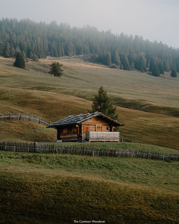
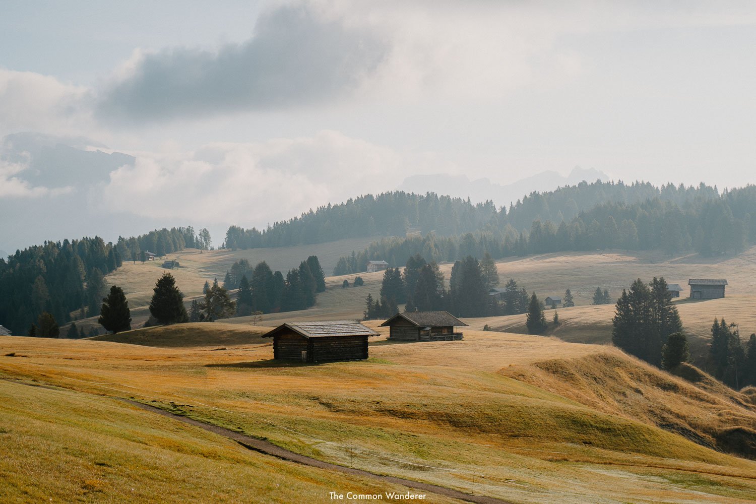
ARMENTARA MEADOWS TRAIL | ALTA BADIA
This is one of our favourite trails in Alta Badia, mostly because it’s fairly easy, but also because it’s super picturesque.
Starting in Badia, take the La Crusc chairlift to the stunning Rifugio Santa Croce, before commencing your hike on trail #15 through the towering larches that straddle the base of Sasso di Santa Croce.
The trail slowly winds its way through the forest before arriving at a rock clearing, where you can make a detour to the ice cave of Grotta della Neve (we suggest this as it’s super cool to see - just be careful to avoid rockfalls and ice melt).
From the cave, take trail #18 which descends through the forested part of the Armentara meadows, before arriving at the open plateau. We suggest stopping for lunch at Ranch da André, a quaint, and quite beautiful alpine hut, for lunch.
From Ranch da André you’ll soon arrive in the Armentara meadows proper. We think this is one of the most underrated and beautiful parts of the Dolomites - similar to Alpe di Siusi, yet with a 10th of the tourists. Take trail #15A back towards Santa Croce / La Crusc (1 hour), slowly meandering the meadows and taking in the stunning vistas.
Once back at Santa Croce / La Crusc, enjoy one of the best apple strudels you’ll ever eat at the rifugio, before ascending to Badia.
NOTE | If you wish to extend your hike, it’s possible to hike back down to Badia from Ranch da André - just take trail #7 all the way down
HIKE DETAILS
Trailhead | Rifugio Santa Croce / La Crusc
Distance | 9km Duration | 3 hrs Difficulty | Easy
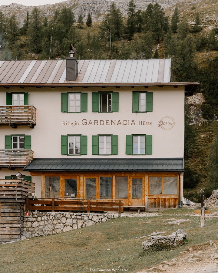
GARDENACIA TO RIFUGIO PUEZ | ALTA BADIA
Taking in the picturesque Gardenacia hut and plateau, as well as the moon-like landscapes on top of the Puez-Odle Nature park, the Gardenacia to rifugio Puez hike is a must when in Alta Badia.
Starting in La Villa, take the Gardenacia cable car before commencing the hike, taking trail #5 to your right. It’s a steep, 40-minute hike to Gardenacia hut, where a coffee or strudel break is called for (or an early schnapps?!), before the real hike starts.
From Gardenacia hut, take trail #5 towards rifugio Puez, which ascends towards the Gardenacia plateau and the famous Alta Badia symbol, Sassongher ahead. The sweeping views of the Fanes mountains are stunning, so make sure you stop for a few photos before continuing your hike.
After an hour or so, the trail veers towards the right (trail #11, and then #15), and through the rocky Gardenacia plateau towards Forcella de Gardenacia. From here, it’s an hour-long hike through the epic high alpine landscapes that adorn the Puez-Odle Nature park to rifugio Puez.
Puez hütte may not be the best mountain hut in the region, but it’s a perfect place to stop and refuel before continuing your hike.
There are two ways to do this - either follow trail #4 towards Forcella di Ciampëi and the Edelweiss hut to Colfosco or take trail #1 back towards Gardenacia hut.
Alternatively, do the trek in reverse, and start hiking in Colfosco, ending at Gardnacia - this option would suit those wishing to stay in a rifugio, and enjoy some of the best food and mountain spritz in the region.
HIKE DETAILS
Trailhead | Gardencia gondola / Colfosco
Distance | 13 km Duration | 7 hrs Difficulty | Moderate
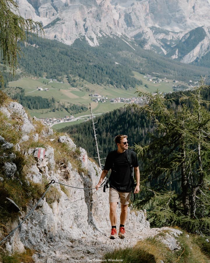
VIA FERRATA ON THE GRAN CIR PEAK | ALTA BADIA
Hiking to the summit of Gran Cir in Alta Badia for sunrise is, for all intents and purposes, tough.
There’s the uncomfortably early start, the incredibly steep ascent, the uncomfortable via ferrata sections, and the final push to the peak.
Yet the sunrise, and view, make the hike unequivocally worth it.
Starting at 4 am (depending on the time of year, it could be earlier or later depending on sunrise times), the hike starts from Passo Gardena (Rifugio Frara) before snaking its way up a scree gully towards the summit. From here, there’s a mix of hiking, scrambling and rock climbing to get to the Gran Cir peak just in time for sunrise.
From the summit, the sunrise is truly spectacular. Enjoy the 360-degree views of the Dolomites surrounding you, including the Sella Group, Sassolungo, and the Monte Antelao and Pelmo.
The hike is perfect for those who seek a little more adventure in their hikes, as well as to witness what may just be the best view in the Dolomites. On the way down, stop in at Jimmy Hütte for a delicious South Tyrolean breakfast.
Alternatively, there are many via ferrata available throughout the South Tyrol region, including around Tre Cime.
THE DETAILS
Where | Pizes de Cir/Gran Cir, Alta Badia
Distance | 4km Duration | 3 hrs Difficulty | Hard
RELATED | Our guide to Alta Badia
Dolomites Road Trip | See the best of the Dolomites
COL RAISER TO SECEDA RIDGELINE | VAL GARDENA
Stunning Seceda, with the peaks of Fermeda Towers jutting out from behind the Seceda mountain, is one of the most instantly recognisable in all of the Dolomites, and a must-visit on any South Tyrol bucket list.
The views from the top overlook many of the Dolomites’ most iconic and stunning peaks, including the Sella group, Sassolungo, and Mt. Schlern, as well as Alpe di Siusi.
The best Dolomites day hike to enjoy these extraordinary views is from Col Raiser to Seceda.
In summer, we recommend taking the Col Raiser chair lift from Plan da Tieja to Almhotel/Col Raiser (€20 return - runs from June 1st - October 15th), and commencing the hike from here (you can hike from Selva di Val Gardena, but the elevation gain makes this one tough hike).
From Almhotel, ascend 1 hour towards the summit of Seceda via path #2. From here, you’ll gain the first views of the incredible Fermeda Towers, and the surrounding meadows of Alpe di Cisles.
Once you’ve admired the view (20-30mins!), head towards the towers, before slowly heading right and down the meadow towards Rifugio Firenze. Depending on your arrival time, rifugio Firenze is a great place to enjoy food, beer or coffee.
From here, it's a short hike back to the chair lift, or a 1-hour hike back down to Selva di Val Gardena.
If you’re a photographer like us and are planning to visit Seceda for sunrise, you’ll need to hike to the summit as the chairlift does not commence until 8 am. Give yourself around 2-3 hours to hike up, bearing in mind the elevation gain is over 1000m.
THE DETAILS
Where | Seceda, Val Gardena
Distance | 8km Duration | 4 hrs Difficulty | Moderate

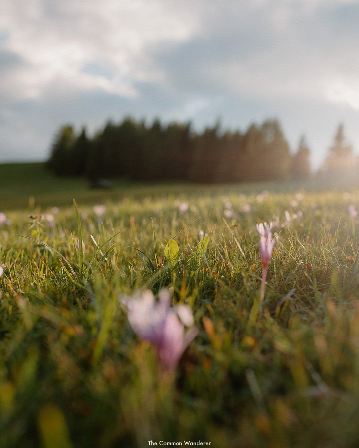
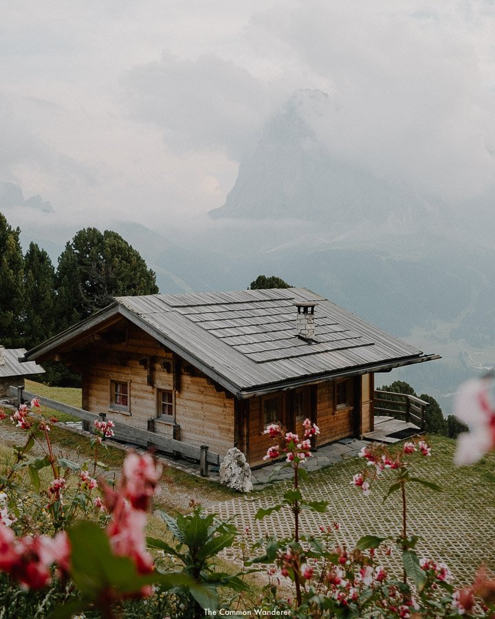
BURNING DOLOMITES HIKE/ SEURASAS | VAL GARDENA
A natural wonder that only occurs in Autumn, a hike to witness the 'Burning Dolomites’ (enrosadira) phenomenon in Val Gardena is a must-do in the Italian Dolomites.
As the leaves begin to turn and temperatures drop, the crisp mountains air and deeper sun create the most epic of sunsets across the jagged peaks of the Dolomites - as the sun begins to set, the grey peaks turn bright orange, then red, framed by the brilliant blue skies. Or so we’re told; on our Burning Dolomites hike, as the sun began to set a thick mist enveloped the surrounding hills, ruining any sunset opportunity much to our dismay. But the hike through the larch forest and views pre-white out were well worth it.
Starting at Cristauta/Praplan, the hike is short at 7km, it’s a very steep ascent to Monte Pic, where the alpine meadow begins and it’s a slow amble to the peak, where you can sit back and enjoy mother nature’s show.
You can also stop at Baita Seurasas Hütte to enjoy an aperitivo and watch the sunset. Burning Dolomites occurs between September 11 and November 1.
THE DETAILS
Where | Burning Dolomites, Val Gardena
Distance | 7.2km Duration | 3 hrs Difficulty | Moderate
Tips | Burning Dolomites occurs between September 11 and November 1
COMPATSCH - RIFUGIO ALPE DI TIRES | ALPE DI SIUSI
For those wanting a moderately challenging day hike with spectacular views over Alpe di Siusi and the famous Sciliar peak, the Rifugio Alpe di Tires trail is perfect.
Starting in Compaccio/Compatsch, the hike heads south towards the imposing Catinaccio mountains, slowly meandering up through the beautiful meadows. Once the hike hits the rocky base of the mountains, the hike starts to get a little harder. There are a number of steep switchbacks before you reach the top of Forcella Denti di Terrarossa, so be careful with your footing.
From here, it’s another 30 minutes until you arrive at the James Bond-esque Alpe di Tires rifugio, where we recommend stopping for lunch, beer and relaxation under the Denti di Terrarossa peaks.
The return hike is much the same way you came, although you can extend the hike by forming a loop back towards Saltria through Passo Duron, and then the bus back to Compaccio/Compatsch. This is intense, so probably best for those with a strong base fitness.
If you’re looking to shorten the hike, you can take the chairlift from Compaccio/Compatsch to Panorama (€10 return).
All in all, this is a great hike to truly admire the soaring peaks and vast alpine pastures of Alpe di Siusi.
HIKE DETAILS
Where | Rifugio Alpe di Tires
Distance | 13 km Duration | 5 hrs Difficulty | Moderate
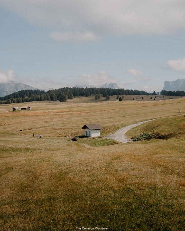
ALPE DI SIUSI PANORAMA WALK | ALPE DI SIUSI
The easiest and most popular walk in Alpe di Siusi, the Panorama Walk offers sweeping views of the surrounding mountain ranges, as well as the vast alpine pastures, so if you’re only visiting for one day, we highly recommend this hike.
Commencing in Compaccio/Compatsch, the round tour first heads east towards the famous rolling hills near Mt. Piz and the Ortisei cable car station.
Here provides some pretty epic views over Val Gardena towards Seceda and the Odle Group, Sassolungo & Sasso Piatto in the near distance, and south towards the famous Sciliar peak.
We recommend stopping at the nearby Malga Sanon for lunch, which has exceptional local food (their dumplings are exceptional, as is the apple strudel!) and the most impressive views over Sassolungo. From here, the hike descends through the meadows to Saltria at the base of Sasso Piatto, before ascending towards the southern part of the region and arriving at the Panorama cable car station. We recommend stopping here for an afternoon snack before jumping on the cable car back to Compaccio/Compatsch.
If you’re not keen to hike the 16km tour, we suggest focusing on the northeastern part of the meadows, toward the Ortisei cable car station, before looping back through the centre of the meadows.
HIKE DETAILS
Where | Compaccio/Compatsch
Distance | 16 km Duration | 5 hrs Difficulty | Moderate
COMPATSCH - RIFUGIO BOLZANO | ALPE DI SIUSI
A long, rewarding trail that takes in the famous Schlern/Sciliar plateau, the hike to Rifugio Bolzano is highly recommended.
Again, the hike starts in Compaccio/Compatsch - you can either hike from town or take the Panorama chairlift and slowly meanders through the alpine meadows of Alpe di Siusi towards Malga Gstatsch Schwaige. From here, continue your ascent towards Baita Saltner/Malga Saltner at which point you’ll join the ‘tourist path’ towards Rifugio Bolzano.
This steep, forested section of the hike is delightful but tough, but once you start to get to the Schlern/Sciliar plateau, you’ll be rewarded with the most incredible views of the Catinaccio/Rosengarten range and Latemar massif, making any pain in the legs worth it.
From here it’s about 20 mins to Rifugio Bolzano, where a long lunch, dessert and a few beers are much needed.
If you wish, you can add a sidewalk onto the hike, taking in Monte Pez/Petz a short 20 minutes away.
To return, follow the path you came towards Compaccio/Compatsch.
HIKE DETAILS
Where | Rifugio Bolzano
Distance | 17 km Duration | 7 hrs Difficulty | Medium
SALTRIA/WILLIAMSHÜTTE - RIFUGIO SASSO PIATTO | ALPE DI SIUSI
The Saltria/Williamshütte to Rifugio Sasso Piatto hike was recommended to us by the owner of Malga Sanon, Luca, when asked “What’s your favourite hike in the region”. And it’s easy to understand why - this hike showcases just about everything we love about the Dolomites; soaring peaks, rolling meadows, and incredible views.
Starting at the Florian cable car near Saltria (you can take bus 11 from Compaccio/Compatsch to Florian chairlift), take the chairlift to Williamshütte, where the hike really commences.
The initial part of the hike is through the higher alpine meadows that sit under Sasso Piatto, before joining an intense, rocky path towards Rifugio Sasso Piatto. The views are outstanding, with Sassopiatto to your left, and vast green hills to your right.
The food at the Rifugio is delicious, so again, we suggest stopping here for lunch and enjoying the views.
The hike back is much the same with a few variations if you wish to extend the hike.
HIKE DETAILS
Where | Saltria/Williamshütte to Rifugio Sasso
Distance | 8.5 km Duration | 5 hrs Difficulty | Hard
VAJOLET TOWERS HIKE
Rising from the rocky Catinaccio mountain group that separates South Tyrol from Trentino are the otherworldly spires of the Vajolet Towers (Torri del Vajolet in Italian), which tower over the landscape below like giant jagged teeth.
The Torri del Vajolet are incredibly popular with rock climbers (and even the odd highline adrenaline junkie), but if you prefer to keep your feet on solid ground, the trail that leads to the Vajolet Towers base makes for an incredible (if not somewhat challenging) day hike in the Dolomites.
With the typically dramatic landscapes and scenery Südtirol is well-known for, without the insane crowds you’d find at other hotspots, like Tre Cime di Lavaredo, the Vajolet Towers hike is a must-see on any Dolomites itinerary.
There are multiple routes you could take to reach these peaks; two starts at Malga Frommer alm (one via Pas De Le Coronelle, and the other following the Via Ferrata Passo Santner), while the third (and easier) hike departs from the town of Pera in the Pozza di Fassa region.
HIKE DETAILS
Where | Vajolet Towers, Dolomites
Distance | 6-8km return Duration | 4-6 hours Difficulty | Hard
READ THE GUIDE | We have a comprehensive guide to hiking to the Vajolet Towers hiking routes, which you can read here
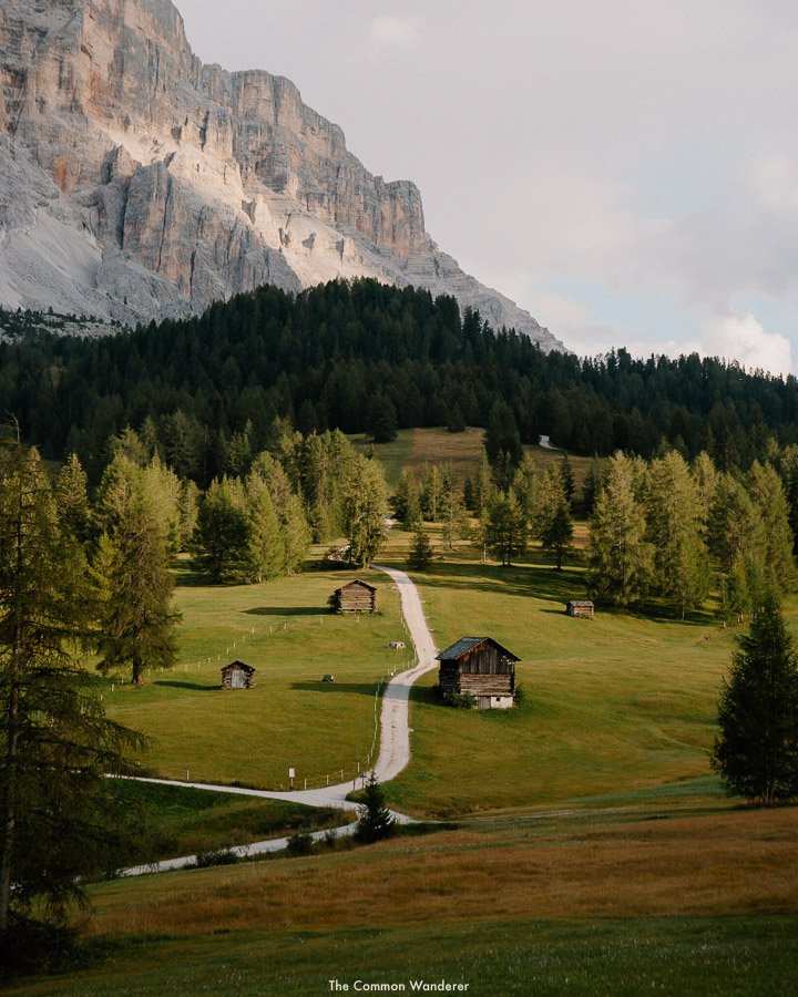
RETURN HIKE FROM PEDERÜ TO FANES HUTTE | FANES NATIONAL PARK
While a lot of visitors to the Dolomites head towards the famous peaks of Tre Cime, Sella or Sassolungo, locals head to Fanes National Park, an otherworldly and awe-inspiring landscape which has literally hundreds of incredible hikes crisscrossing its hills.
The best day hike to enjoy the park’s amazing landscapes is via the return hike from Pederü to Fanes Hutte.
Start at the quaint Pederü Berggasthaus, which is perfect for pre-hike coffee and kaiserschmarrn (a delicious South Tyrolean dessert). From here, the 4-hour return hike commences towards Fanes, following a steep incline before flattening out in the upper valley.
Here, the unique mountainscapes become more rugged and imposing, with the jagged orange and sand-coloured peaks towering high above. For those of you who have visited or seen images of Yosemite National Park in the states, the views here are very similar.
The path continues through a small forested valley before another incline will have you gasping for breath. Fortunately, there are many areas to stop and enjoy the views (and rehydrate), before the path again flattens out towards Fanes Hütte.
Built-in 1928, the picturesque Fanes Hütte is set amongst the pines and lakes of Fanes NP, and is the perfect location to enjoy a typical mountain meal - traditional Tyrolean dumplings with spinach, washed down with a Forst beer.
From Fanes Hütte, hike a further 30 minutes up towards Lago di Limo alpine lake for some more impressive views of the unique landscape. At this point, we recommend heading back in the direction you came, slowly making your way towards the car park.
THE DETAILS
Where | Fanes National Park
Distance | 14.4km return Duration | 4-6 hours Difficulty | Moderate

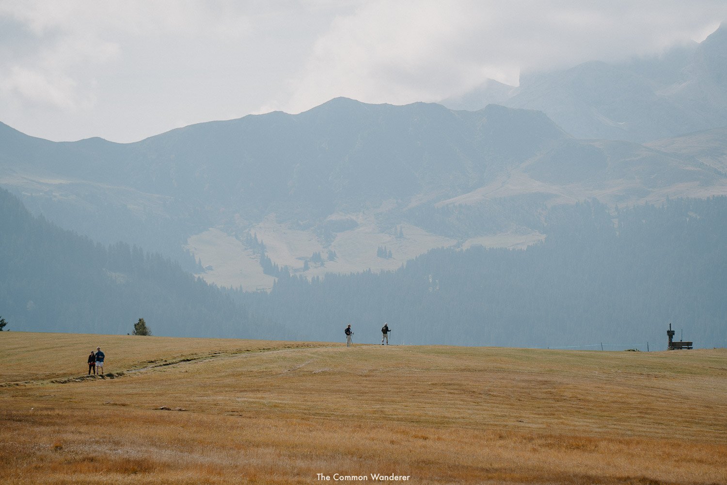
SHORT AND SWEET HIKES IN THE DOLOMITES
If you’re short of time, or just looking to spot a few of the Dolomites’ main attractions without hiking, here are a few (very) short hikes to enjoy.
THE LAGO DI BRAIES LOOP
Arguably Europe’s most beautiful lake, Lago di Braies is the jewel of the Dolomites.
The crystal clear alpine lake is surrounded by towering peaks and dense spruce forests, which, coupled with the impossibly quaint lakeside cabin, provides the most picturesque photo opportunity.
For those wanting to see more than the stock standard views from Lago di Braies, we recommend taking the easy 1-hour hike around the lake.
The walk allows you to enjoy the lake from multiple different perspectives, as well as escape the hordes of crowds that mingle around the boat shed.
For the best views, stop at the multiple lookout points on the left side of the lake.
READ MORE | Our complete guide to Lago di Braies
LAGO DI DOBBIACO LOOP
While Lago di Dobbiaco may not be as awe-inspiring as Lago di Braies, it still provides an epic backdrop for a short hike in the Dolomites. The hike is super accessible, nestled on the road between Lago di Braies and Tre Cime di Lavaredo. Starting at the parking lot near the lake, the hike passes through stunning forests and along the lakeshore.
The trail has a number of benches and picnic areas, making it an ideal spot for a relaxing picnic lunch or snack break. Completing the 3km hike will take around 45 minutes, depending on your pace and how many photography breaks you take.
As you hike, you will be treated to absolutely stunning views of the surrounding mountains, including the famous Three Peaks of Lavaredo to the left of the lake. The lake itself is also a highlight of the hike, with its crystal-clear water providing beautiful reflections of the surrounding mountains.
Overall, the Lago di Dobbiaco loop is a manageable hike for anyone visiting the Dolomites. With its incredible scenery, manageable difficulty level, and relatively short distance, it's the perfect hike for those visiting Lago di Braies and Tre Cime di Lavaredo on the same day.
LAGO DI CAREZZA LOOP
The emerald waters of Lago di Carezza are some of the most beautiful in all of the Dolomites, and this alpine lake in the upper Val' d’Ega (also known as Karersee in German), with its picture-perfect reflections of the Latemar range, has long made it a popular choice with tourists and photographers alike (read our complete guide here).
While the lake is located just off the main road, there’s actually a short walking circuit around the lake which often gets overlooked.
The walk takes about 20 minutes and winds through the beautiful Spruce forest surrounding the lake, providing a number of awesome and alternative points to view the lake.
There are a few spots to sit down and enjoy the views, or simply sit and soak up all the lush nature around you.
And while it’s only a (very!) short hike, it’s very much worth it.
For those wanting a longer hike to/from Lago di Carezza, consider these:
TEMPLWEG TRAIL FROM OBEREGGEN
This trail (#8) takes you from Obereggen (or you can also opt to go from Ega) through the beautiful green Spruce-forest of the Karerwald (Karer Forest) to the lake, with a possible detour to the Stadlalm Farm for lunch and a refreshment in the sun.
Distance | 13.3km
Length | 3.5-4 hours
Elevation | 169m
Starting point | Obereggen upper car park
Finish point | Lago di Carezza (can also be done in reverse)
LAGO DI CAREZZA / KARERSEE HIKE FROM NOVA LEVANTE
This trail takes you from the town of Nova Levante, the closest town to Lago Di Carezza, along a small river and through the pretty forest scenes to the lake. It’s initially a little steep, but otherwise relatively flat and a great circuit for a family or those who want to go for a ramble but not an epic hike.
Keep following the signs to the lake, and when you’re done simply retrace your steps back again.
Distance | 3.5km
Length | 1-1.5 hours
Elevation | 350m
Starting point | Sawmill Latemar (Nova Levante)
Finish point | Same as start
A MAP OF THE BEST DOLOMITES HIKING TRAILS
We’ve created a detailed map of the best Dolomites hikes which you can download for your visit.
To save our map, click the star to the right of the map title while will download the map to your places - maps in your Google account.
DOLOMITES HIKING FAQS + ESSENTIAL INFORMATION
WHEN IS THE BEST TIME TO HIKE IN THE DOLOMITES
We think the best times to hike in the Dolomites are September and October. The crowds are gone by then and the weather is still nice.
You won't have the trails to yourself, but you can still enjoy the beautiful surroundings without the summer crowds. Spring is also a great time to visit (mid-June to July) with wildflowers in bloom and snow still on the upper mountains.
If you're hiking during the busy summer months, start your hike as early as possible to avoid crowds.
TIP | Late summer or spring is best for Dolomites hiking.
OUR TOP DOLOMITES HIKING TIPS
You can’t trust the mountains; that’s our motto when we head out for a hike anywhere in the world.
Truth be told, we’ve managed to enjoy pretty beautiful weather during our time in the Dolomites, however, our guides have told us horror stories of rapidly changing weather and treacherous hiking conditions.
Here are a few tips to help you out:
Pack for four seasons, even in summer. These mountains can be unpredictable so always pack warm gear
Visit in shoulder season to avoid the summer crowds when the hiking paths get super busy
Wear sturdy, strong hiking boots as the rocky paths can be slippy at times
The Dolomites hiking pathways are well-marked with signposts and red and white markers. If in doubt, use Google Maps or Maps.me
You’ll never be far from good food and beer, so embrace it! It’s Italy after all
You can sleep in the mountains but need to book rifugios well in advance
Always travel with travel insurance (see below). The unexpected can, and does, happen in the mountains and it's always better to be prepared.
Smile, nod and say hello (in whatever language) to your fellow hikers
RESPONSIBLE DOLOMITES HIKING TIPS
The Dolomites are a UNESCO World Heritage site, known for their dramatic peaks and pristine natural environment, but in recent years have become even more popular through Instagram and other social media apps.
This has led to some pretty bad behaviour in and around the area, as well as the dreaded impacts of over-tourism.
Therefore, even when enjoying a short hike in the region, it’s important to remember a few key rules:
THE DOLOMITES AREN’T YOUR INSTAGRAM PLAYGROUND | The Dolomites are an incredible natural phenomenon perfect for photography and Instagram, but that doesn’t mean you have free reign to break rules, ruin natural environments and use it as your playground (read our responsible travel tips here).
Although we’ve not been able to find adequate information about flying drones in the Dolomites, respect the usual rules of flying and be super careful.
BRING A REUSABLE WATER BOTTLE | There is no need for a modern traveller to buy bottled water, ever. Purchase a water filtration + purification bottle (like our faves from The Grayl) and you will literally never need to purchase bottled water again.
BUY | We use the Grayl GEOPRESS every day, every trip we take!
TREK AT THE TAIL ENDS OF THE SEASON | Dolomites hiking trails can get extremely busy in the height of summer, so we suggest trekking either side of the peak periods to avoid contributing to over-tourism and environmental degradation.
It’s also a good idea to arrive early in the day to avoid crowds, which in our opinion makes the experience far better.
RESPECT THE LOCAL ENVIRONMENT AND CULTURE | This part of Italy, which borders South Tyrol and Verona communes, has a unique and rich culture, steeped in religious and historical significance.
Around Tre Cime di Lavaredo (the Three Peaks) and other parts of the Dolomites, historical WW1 battles were fought and the remains can be seen everywhere.
Respect these sights, and do not under any circumstance, remove anything from the national park.
DON’T LITTER | Whatever you do, don’t litter in this pristine natural environment. Where you can, avoid plastic altogether on your trek, and if you can’t, carry it out of the national park with you.
PICK UP ANY TRASH YOU SEE | Although we (thankfully) haven’t seen much rubbish on the trails that we’ve seen while hiking in the Dolomites, the odd piece can still be found. If you come across rubbish on your trek, collect it in a tote bag and take it off the trails with you to dispose of it properly later.
THE BEST DOLOMITES HIKING BASE
Deciding where to base yourself in the Dolomites to maximise your hiking opportunities can be tricky. However, there are a few areas we suggest basing yourself for the easiest access to the best Dolomites hikes.
VAL GARDENA
The Val Gardena valley lies to the west of Alta Badia, and is close to Alpe di Siusi meadow and the striking Seceda ridgeline, among other incredible Dolomites hikes.
Hotels in the region we recommend include DorfHotel Beludei, Hotel Grones, Adler Mountain Lodge in Alpe di Suisi.
ALTA BADIA
From rustic alpine meadows to thick forests, towering craggy mountains to quaint mountain chalets (serving award-winning gourmet fare, no less!), the valley of Alta Badia is where the heart of the Dolomites can be found.
We suggest staying at Garni Edera, Mountains Hotel Mezdi or Rosa Alpina Hotel & Spa, depending on your budget.
CORTINA
Known as the Queen of the Dolomites, Cortina d’Ampezzo is renowned amongst Dolomiti hikers, skiing enthusiasts, and socialite jet setters alike.
From here, you also have easy access to some of the best hikes in the Dolomites, including Tre Cime di Lavaredo (Drei Zinnen), Lago di Sorapis and Lago di Braies.
We suggest staying at one of these exceptional hotels: Hotel Olimpia, Hotel Europa, or the luxurious Cristallo Luxury Resort & Spa.
BOOK | Search for your ultimate Dolomites accommodation
HOW TO GET & AROUND THE DOLOMITES
Wondering how to get to the Dolomites? Read our guide, which contains everything you need to know. Below is an easy overview of how to get to the Dolomites:
TRAIN
In our opinion, the best and most environmentally friendly way to reach the Dolomites is by train.
If you're travelling by train from Germany, Switzerland, Austria, or Italy in the south, stop at Bolzano station, the main hub for the region.
We suggest booking well in advance, especially during the summer, which you can do here
BOOK | Plan your journey and book tickets here.
FLY
Even though there are no airports in the Dolomites, the main attractions can be reached from three airports within three hours. Alternatively, major international airports are available four to six hours away.
The closest airports are:
Verona Villafranca International Airport - Italy | 2.5 hours
Marco Polo International Airport, Venice - Italy | 2.5 hours
Innsbruck - Austria | 2 hours
Other major international airports within a 4-6 hour radius include:
Zurich Airport – Switzerland | 5-6 hours
Malpensa Airport – Milan, Italy | 4-5 hours
Munich International Airport – Germany | 3-4 hours
BOOK | Check flight dates and prices here
TIP | Shuttle buses are available daily to South Tyrol from the airports of Innsbruck, Salzburg, Munich, Treviso, Venice, Verona, Bergamo, and Milan Malpensa. Learn more here.
RELATED | How to get to the Dolomites, Italy
FOLLOW OUR ADVENTURES | @THECOMMONWANDERER
HOW TO GET AROUND THE DOLOMITES
CAR
We highly recommend hiring a car for the duration of your stay in the Dolomites - it makes reaching all the wonderful natural attractions very easy and gives you far more freedom than public transport.
We’d recommend hiring a car in Bolzano, which is pretty much the gateway to your Dolomites adventures. Alternatively, you can hire a car at any arrival point in the surrounding regions and cities.
Expect to pay anywhere between £80 - £200 for a 7-day car hire, excluding insurance (depending on car type).
BOOK | Check prices and dates for car rental here
READ | Our 7-day Dolomites road trip itinerary
PUBLIC TRANSPORT
If you’re not keen to hire a car, the public transport system around the Dolomites is exceptional - the region is very well connected via a system of buses, regional trains and cable cars.
Organise yourself a South Tyrol Mobilcard, for one, three or seven days, and gain access to all the other transport options throughout the region.
Tickets can be purchased at tourist information centres, hotels, and ticket machines.
THE DETAILS
What | South Tyrol Mobilcard
Cost | €15, €23, or €28 respectively for 1, 3 and 7 days
TRAVEL INSURANCE | STAY SAFE IN THE DOLOMITES
If you can't afford travel insurance, you really can't afford to travel. As the current global situation has taught many people, things can go wrong anywhere in the world - and insurance is often the only way of mitigating any issues with minimal expense or stress for you.
For all travellers | HeyMondo - COVID-19 coverage, comprehensive travel + medical insurance, an app with 24-hour medical support, and no out-of-pocket fees. *Get 5% off your policy by booking through our link here.
For digital nomads | SafetyWing - COVID-19 coverage, comprehensive travel & medical, and policies can be purchased while already abroad.
Car Insurance | Insurance4CarHire - a great annual car insurance policy
PLANNING A TRIP TO THE DOLOMITES SOON?
Check out these essential posts to help you have the best trip ever:
DOLOMITES | Our Dolomites Travel Guide, Top things to do in the Dolomites, Our 7-day road trip itinerary for the Dolomites, Where to stay in the Dolomites, How to get to the Dolomites
DOLOMITES DESTINATION GUIDES | Summer in Alta Badia, A guide to Val di Funes, A complete guide to Alpe di Siusi, How to visit Lago di Carezza, our guide to Lago di Braies,
HIKES TO REMEMBER | 7 of the best day hikes in the Dolomites, including the famous Tre Cime De Lavaredo loop, Violet Towers hiking guide, Hiking to Lago di Sorapis, Cadini di Misurina
SOUTH TYROL | 19 amazing things to do in South Tyrol during Summer, plus everything we love about the beautiful South Tyrol region
PHOTOGRAPHY | Love our photography? Grab the presets we use on every photo here
RESPONSIBLE TRAVEL | Responsible travel is important. REALLY IMPORTANT. Learn our top responsible travel tips to help you, your family and your friends travel more consciously around the globe
ECO-FRIENDLY PACKING ESSENTIALS | Don’t leave home without our favourite eco-friendly travel essentials
EXPLORE THE BEST OF THE DOLOMITES WITH THESE POSTS
![These are Bologna’s Best Airbnbs [2026 Guide]](https://images.squarespace-cdn.com/content/v1/5a3bb03b4c326d76de73ddaa/1611746564754-PVYN1P1QGYZWXT2XZS6G/The_Common_Wanderer_-6.jpg)


Some of the links on this Dolomites Hiking Guide are affiliate links.
If you choose to purchase using these links, we receive a small commission at no extra cost to you. Please know that by using these affiliate links, you're directly supporting The Common Wanderer to stay wandering, the running costs of the site, and our ability to provide you with free content to help you on your travels.
That, and you're officially a legend.